
When you think of Scotland, it’s likely that images begin to swim through your mind of vast landscapes coated with dense forests and striking hills overlooking endless lochs.
This idyllic picturescape could easily be the Tay Forest Park, an area of exceptional natural beauty within the Perthshire region in Scotland.
This protected pocket of wilderness has everything from towering peaks to some of Scotland’s largest lochs, forests alive with native wildlife and spectacular waterfalls.
In this guide we’ll delve into everything you need to know about the Tay Forest park and its array of walks.
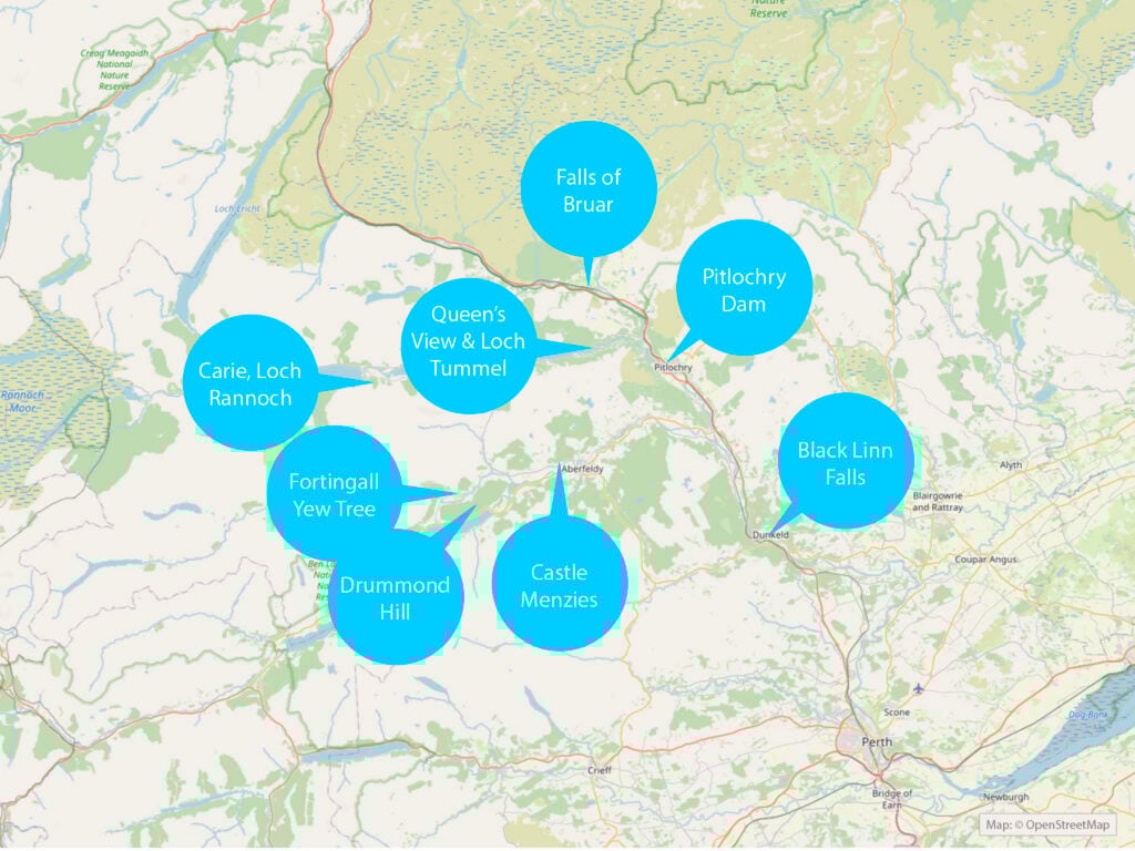
Tay Forest Park Map
What is Tay Forest Park?
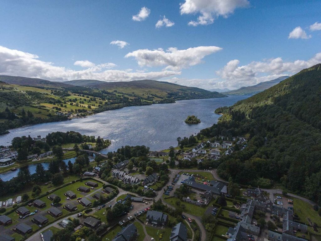
Covering nearly two hundred square kilometres, the Tay Forest Park is one of the most pleasant natural attractions in Scotland.
As the title implies, it is a forested nature park in Perthshire.
The park is made up of panoramic viewpoints, forests of spectacularly tall trees, ancient castles and much more. Throughout the park there are countless walks which you can enjoy.
It’s known as a jewel amongst the many inspiring nature landmarks in that beautiful part of Scotland, popular with both locals and visitors from further afield.
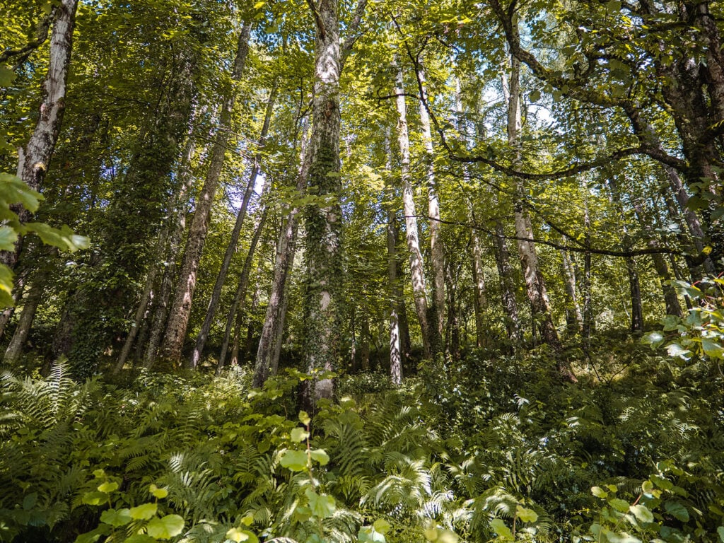
Good to Know! The Tay Forest Park is in the ‘Big Tree Country’ and is home to some record-breaking tall trees. In Craigvinean you will find one of the tallest trees in the UK, standing at 194 feet (59 metres) tall.
Where is Tay Forest Park?
The Tay Forest Park is located in rural Perthshire in Scotland, lying to the west of the small towns of Dunkeld, Aberfeldy and Pitlochry.
The official postal address for the Tay Forest Park is given as Weem Forest, PH15 2JD. However, the exact postcode will vary depending on which area of the park you visit – the park covers a vast area!
The areas within the Tay Forest Park include: Craigvinean, Rannoch, Allean, Faskally, Drummond Hill, Weem, Grandtully, Queen’s View, Braes of Foss, and Dalerb.
What is There to See in Tay Forest Park?
Being large and unspoilt, the Tay Forest Park is known for offering a variety of visit experiences. Below we’ll go through some of the most spectacular attractions within the park.
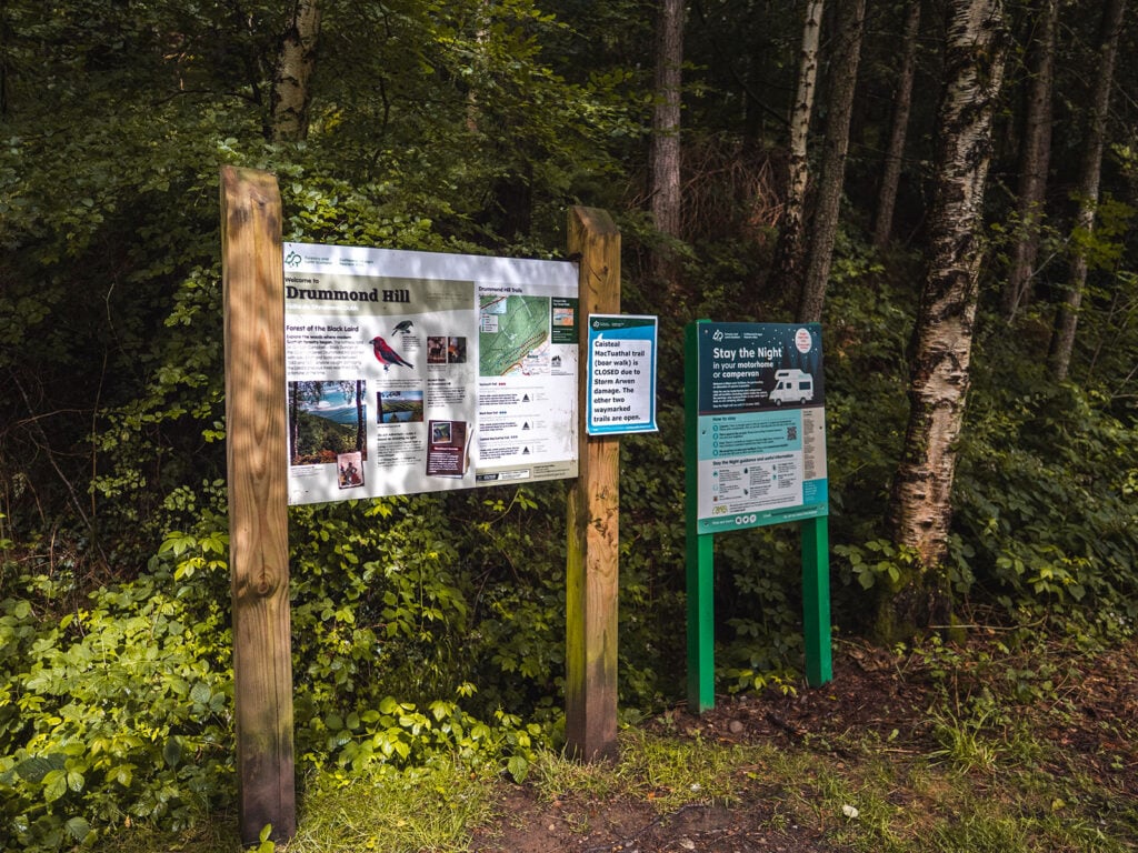
1. Drummond Hill
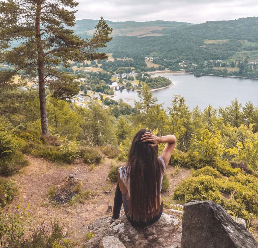
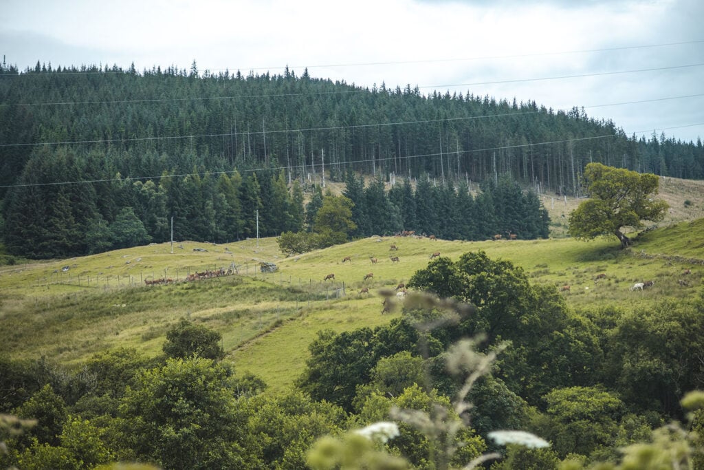
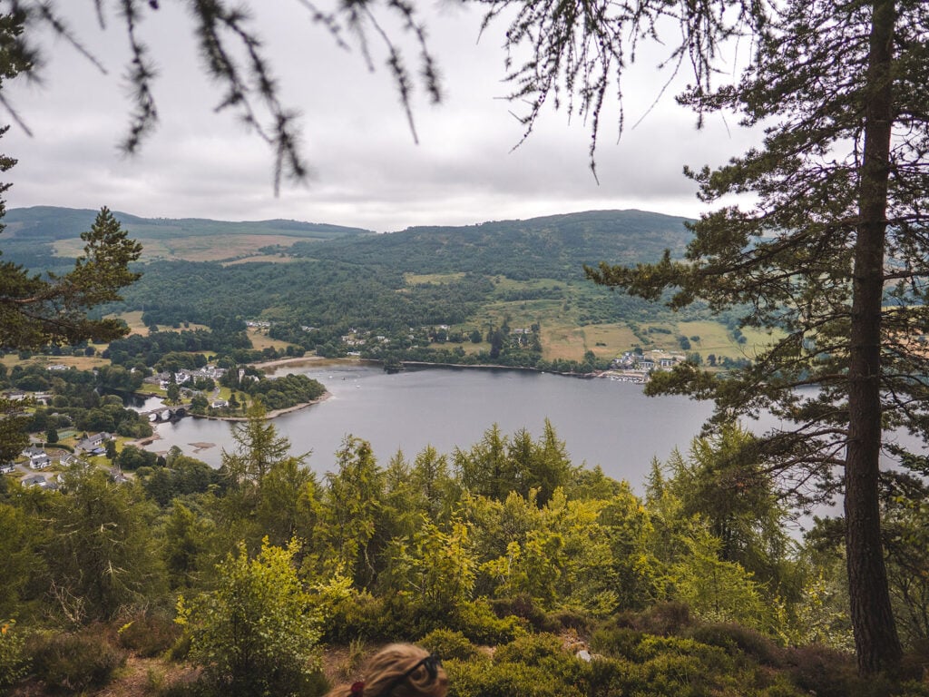
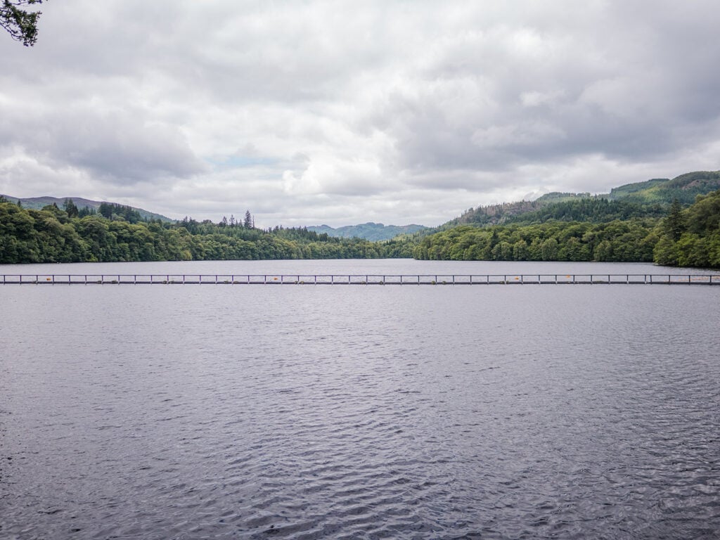
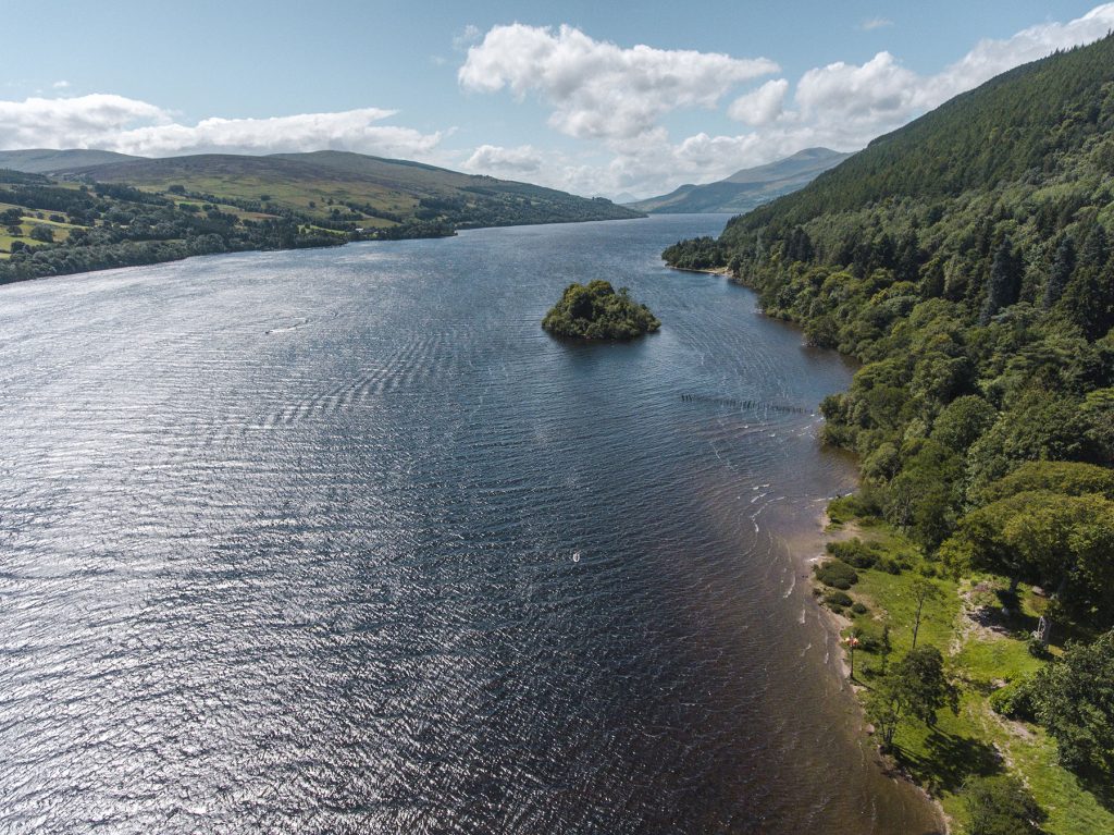
Rising from the northern banks of Loch Tay is a hill stretching upwards to a height of 460 metres. Dressed in oak, birch and Scots pine, Drummond Hill is one of the most popular segments of the park, with the hill providing panoramic views of the nearby village of Kenmore as well as the magnificent Loch Tay, the sixth largest loch in Scotland.
This special area of forest has been a managed forest for five hundred years or so and is known for its beauty and the variety of trees planted there which provide habitat for an abundance of wildlife including the rare capercaillie. So well regarded is the area that a century ago the newly-created Forestry Commission of the UK made Drummond Hill one of its first purchases.
Close to Drummond Hill stands the enigmatic Caisteal MacTuathal, which is the remains of an Iron Age hill fort, with a very clear view to Strathtay.
Drummond Hill is the starting point for a number of nature walks that can be done through the Tay Forest Park such as the hike to the Black Rock Viewpoint.
Drummond Hill includes a free car park and also welcomes a limited number of small caravans or motorhomes over the summer season.
Good to Know! There are 3 walking routes you can take up Drummond hill: Taymouth Trail (2 ½ miles), Black Rock Trail (2 ¾ miles) and Caisteal MacTuathal Trail (5 ¾ miles).
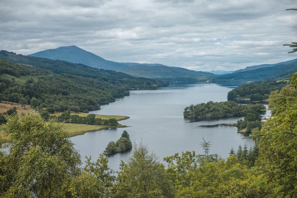
2. The Queen’s View
Reputedly named in honour of Queen Victoria after her visit to the area in 1866, the Queen’s View is one of the most special panoramas in the whole of Scotland and has a special place in the hearts of visitors to the Tay Forest Park.
Others, however, have argued that the name derives from a visit by Queen Isabella of Scotland over half a millennium earlier. Whichever derivation is most accurate, Queen Victoria certainly stayed in the area and remarked upon it.
The viewing platform lies to the east of the majestic Loch Tummel and is accompanied by a cafe as well as ample parking.
The view itself certainly lives up to its reputation, providing panoramic views of Loch Tummel and the surrounding forest as well as the distant peaks of Glencoe.
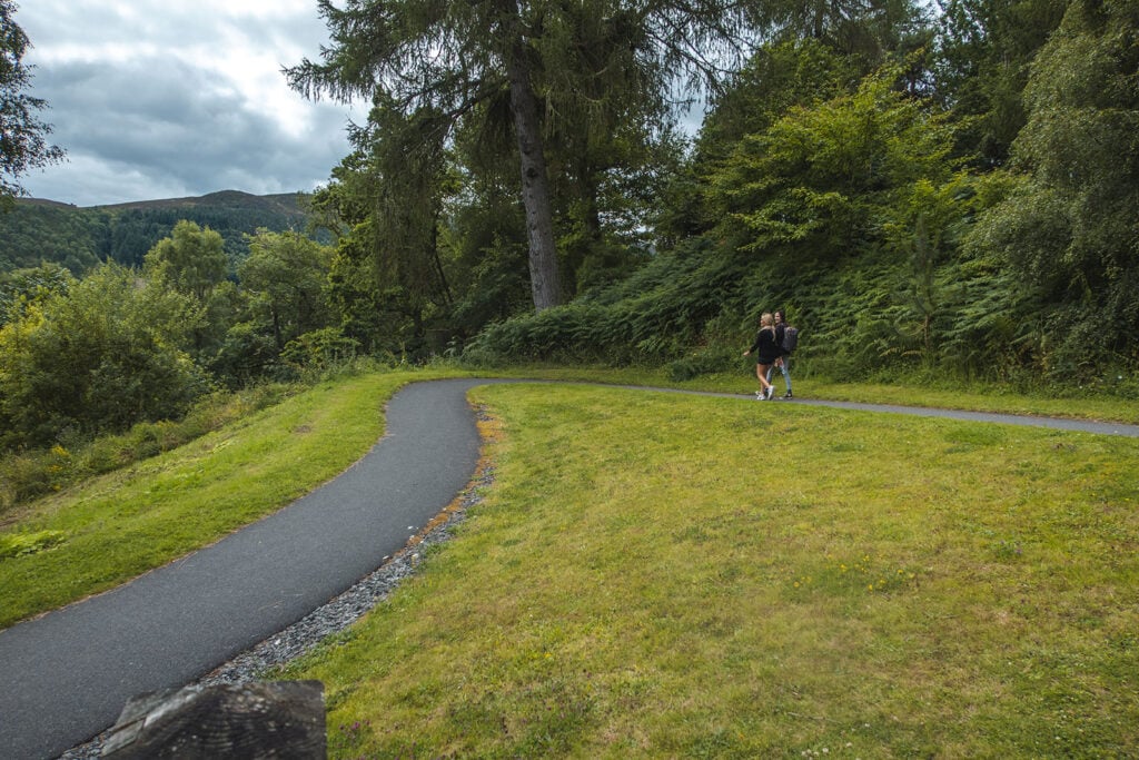
The walk to the Queen’s View from the car park is a short one, around 5 minutes upon a wide, tarred, gently sloping path.
For the more adventurous visitors there are some far longer walks just a short stretch down the road. An example is the Allean Trail. This 4-kilometre walk takes over an hour and is not especially strenuous for seasoned walkers, though of course there is some uphill and downhill walking required.
You can drive to the Queen’s View and park there for £2 per day (higher fees for coaches and minibuses), with blue badge holders parking for free. It is definitely worth visiting because it includes a Visitor Centre with lots of information about the locality, including walks.
There are also good toilet facilities as well as a shop and café with a good selection of food and drinks. Dogs are welcome in the outdoor seating area, making it the perfect spot to relax for all visitors.
If you wish to complete one of the area’s walks such as the Allean Trail before or after your trip to the Queen’s View then I’d recommend moving to park at the start of the trail to avoid walking on the main road which has no pavement. The parking here is free of charge.
3. Loch Tummel
From the Queen’s View there is a very clear vista down to Loch Tummel, one of the most enchanting lochs in Scotland. The whole of the loch can be seen from a high enough vantage point, but that isn’t the only way to enjoy Loch Tummel.
Some eleven kilometres in length, the loch is certainly picturesque but is also the lifeblood of the small community of Tummel Bridge, which nestles on its shore. It’s located to the west of the lively town of Pitlochry.
You can enjoy a spot of watersports on the loch or even some sailing. Perched upon the shores of the loch is Loch Tummel hotel which has a lovely bar overlooking the loch.
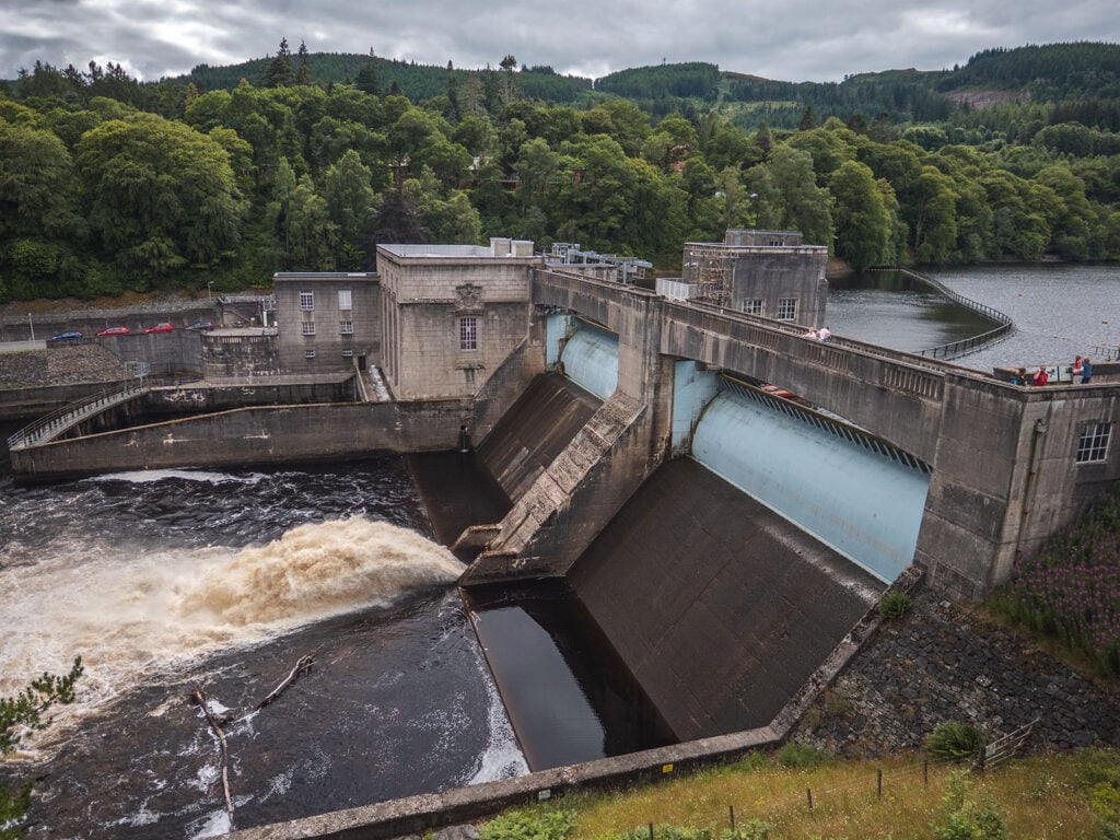
4. Pitlochry Dam
Situated within the Tay Forest Park is Pitlochry, a town famous for the impressive Pitlochry Dam, one of Scotland’s earliest and most impressive hydroelectric schemes.
The dam also created the pretty Loch Faskally, a reservoir at the top of the dam, as a by-product of its design and construction.
You can observe the way in which the dam harnesses natural energy, and also enter an impressive visitor centre to learn more about this iconic project, which is all about opening minds to the potential of renewables.
Since 2017 the company which owns Pitlochry Dam, SSE, has operated a new visitor centre on the edge of the water. This stunning £4 million building is now a tourist attraction in its own right and has been awarded and recognised for its value to green tourism.
There is parking at the visitor centre as well as a café selling drinks, cakes and deli snacks.
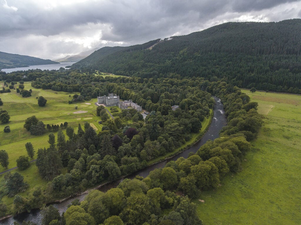
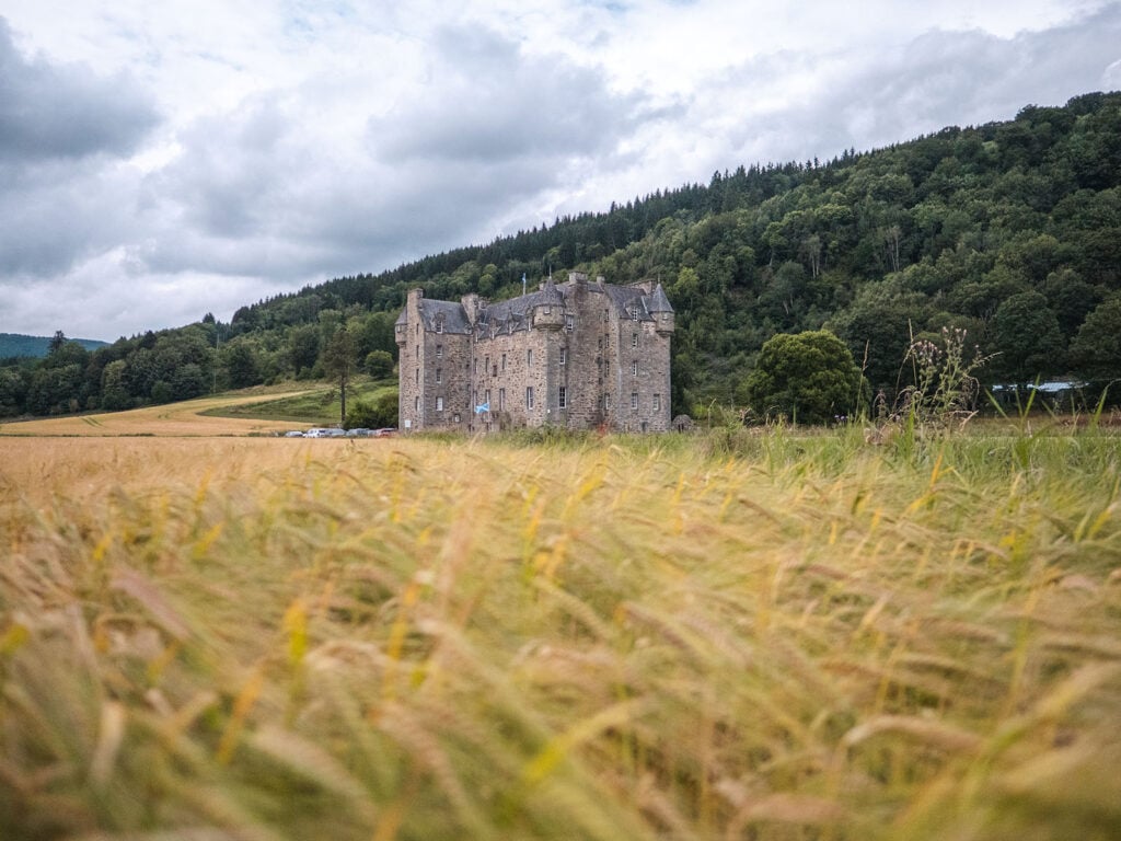
5. Castle Menzies
A striking pearl within the Tay Forest Park is Castle Menzies, which is the ancestral focus of Clan Menzies, and one of the most important houses in Perthshire.
Built in the sixteenth century, architecturally it fuses the more rugged style of earlier Scottish castles with the manor houses of later centuries, and is a building of significant historical interest.
Clan Menzies renovated the castle when it bought back the property around seventy-five years ago, and the castle has now been restored to its majesty and authority. It includes a visitor centre which explains its fascinating history and place in the story of Scotland. The Clan meets there every year and also undertakes significant charitable and community work throughout the local area.
The Castle is located near the village of Weem, which is in the vicinity of the town of Aberfeldy.
You can visit the Castle during the summer months on most days. Entry costs £9 for adults, and there are reduced rates for children depending on ages. Outside the summer season, private tours can also be arranged for a fee. Parking is included in the entry cost. It’s definitely worth checking before visiting though, because the Castle can also be hired for weddings and conferences, and on these days it is not accessible to the public.
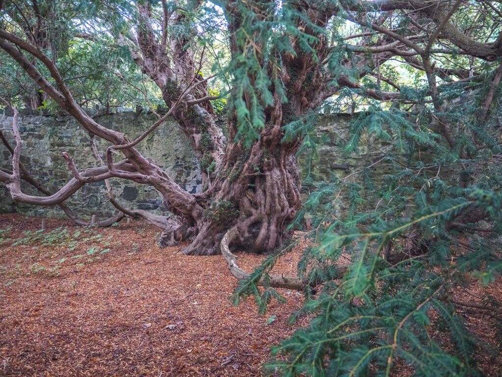
6. Fortingall Yew Tree
The Fortingall Yew Tree is perhaps the most famous tree in Scotland.
It takes its name from the small village in which it is located. Fortingall derives from Fartairchill, which may be translated as something close to “Escarpment Church” in Gaelic, and it is known this has been a site of religious significance even before the arrival of Christianity.
The Yew stands close to the church and has been dated as somewhere around 5000 years old, though some estimates argue it may be as much as 9000 years old. As such it can lay claim to being one of the oldest living things in Europe.
The Yew is the main reason to visit the village, though the church is also rather pretty. There is parking in the village but please consider the locals and be careful not to block entrance ways.
Did You Know? The exact age of the Fortingall Yew Tree remains unknown. Experts say it could be between 5000 and 9000 years old, which would make it the oldest living tree in Europe.
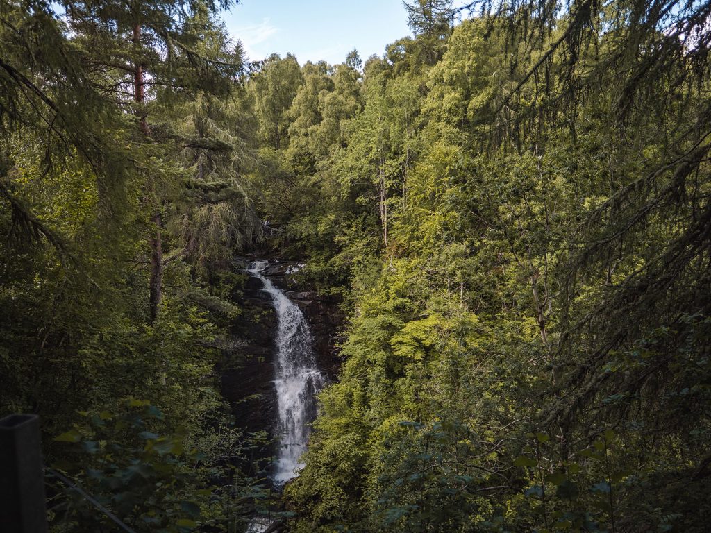
7. Black Linn Falls
As the Tay Forest Park is so large, it encompasses several smaller waterfalls, but the most notable is probably Black Linn Falls.
This waterfall lies on the river Braan in The Hermitage near the small town of Dunkeld. Its most special feature is the look-out folly called Ossian’s Hall of Mirrors, which was constructed to capture and reflect the light and impact of the Black Linn Falls. You can get a whole different perspective when you enter this structure, which is now over two hundred and fifty years old.
Since 2007 the National Trust of Scotland has opened Ossian’s Hall of Mirrors to the public.
Did You Know? Black Linn Falls is one of many waterfalls in the Perthshire area. Here are some other spectacular waterfalls in Perthshire:
8. Tay Forest Park Wildlife
There is a wide variety of wildlife throughout the Park, sustained by a vast green and natural environment.
At Loch Tummel and other lochs you will encounter many types of water bird including herons, kingfishers and ducks, some breeds of which are rare. Deeper into the woodland live red deer and squirrels as well as the rarer pine martens.
Often the most remembered creature is the capercaillie – if you are lucky enough to encounter one! The capercaillie is a rare and large woodland grouse and this strange-sounding ‘horse of the woods’ is most likely to be found – if found at all – near Drummond Hill.
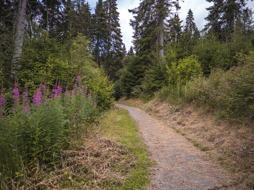
Tay Forest Park Walks
As you can imagine, with almost two hundred square kilometres of park to explore, there are some incredible walks available in Tay Forest Park. These walks can be chosen or tailored to suit all forms of energy and experience.
Below I will go into some of my favourite walks in Tay Forest Park.
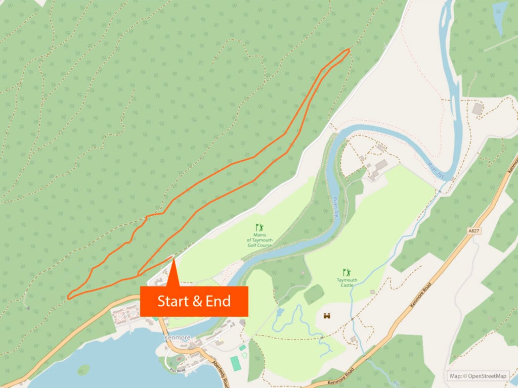
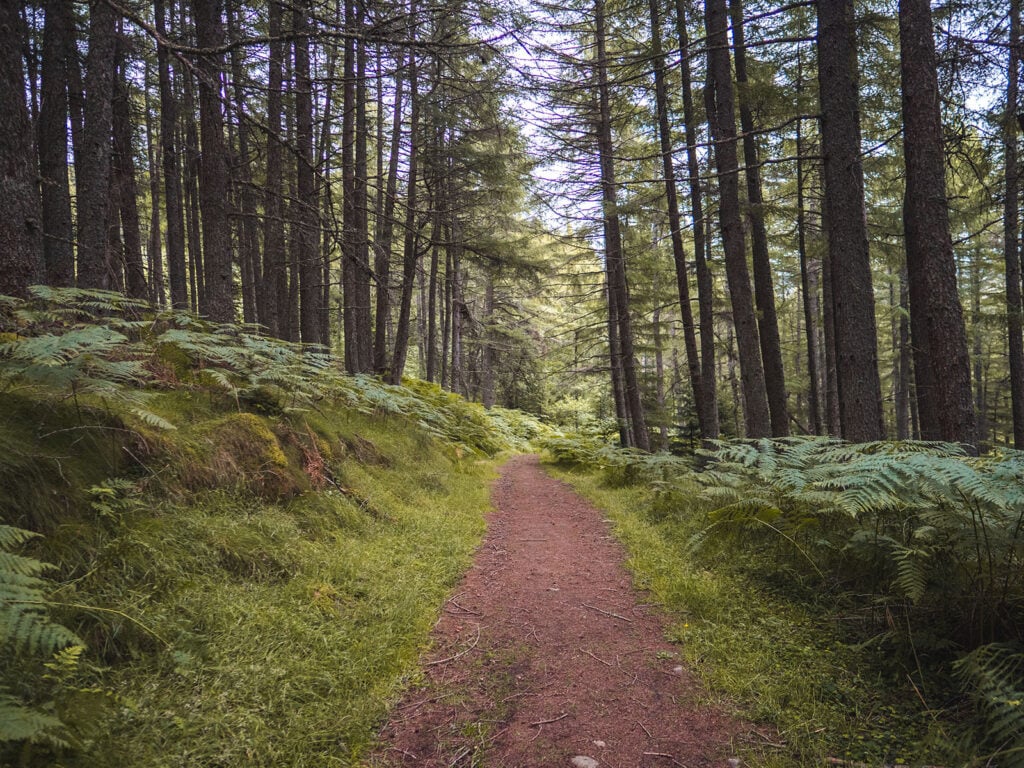
Drummond Hill Walks
At the east end of Loch Tay, you can find Drummond Hill and the three joyful walks that begin there. All three walks have the same starting point which lies at the foot of the hill, just behind the Mains of Taymouth estate.
Head for the village of Kenmore within the Tay Forest Park and you can park there at the Taymouth courtyard, which also has a toilet and a café. The trails are a five minute walk away from here. Simply follow signs for ‘Drummond Hill Forest Walks’ from the A827 as it passes through the northern end of Kenmore village.
Alternatively you can park in Drummond Hill car park which is right at the start of the trails. To find the car park, follow signs for ‘Drummond Hill Forest Walks’ from the A827.
Both parking options are free and entry to the Drummond Hill itself is also free.
Good to Know! The nearest postcode is PH15 2HN
1. Taymouth Trail
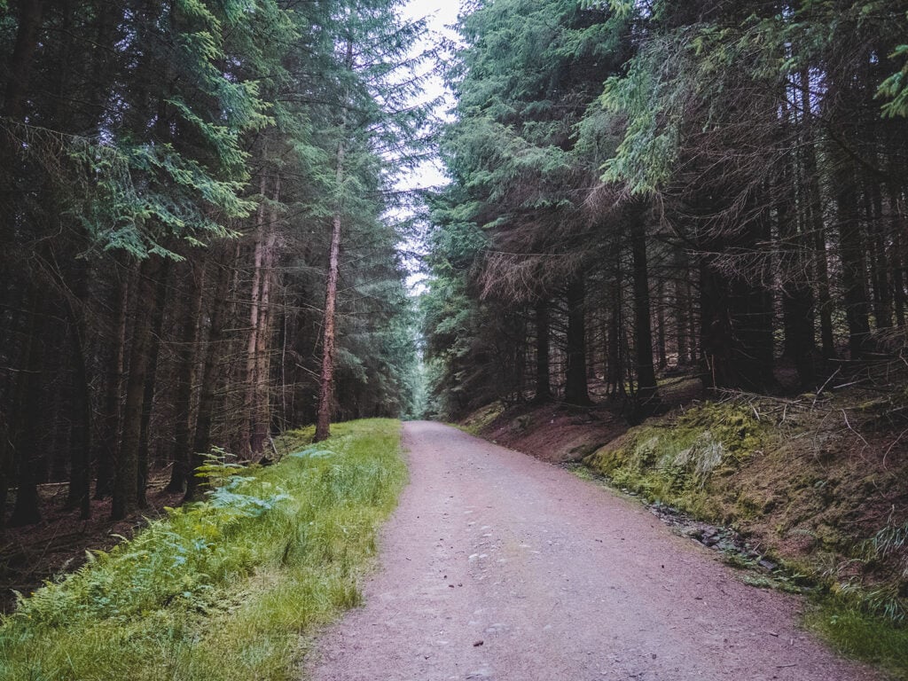
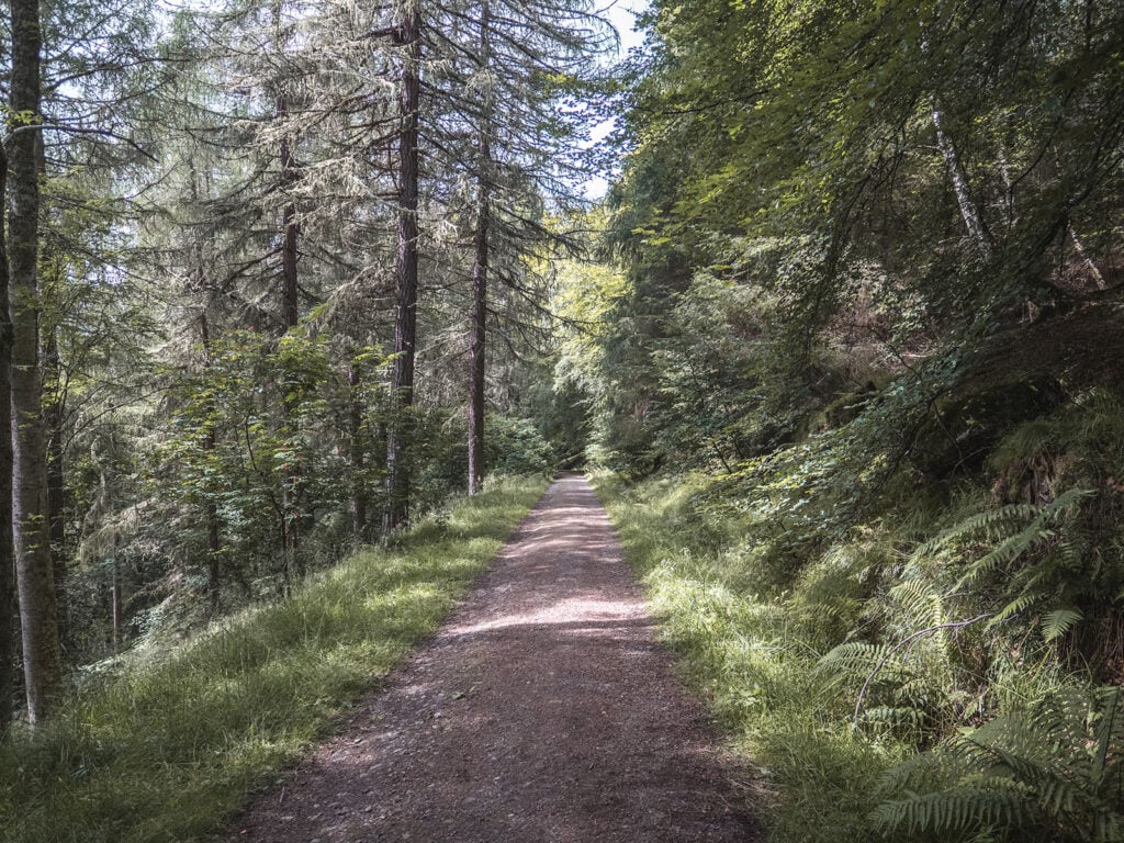
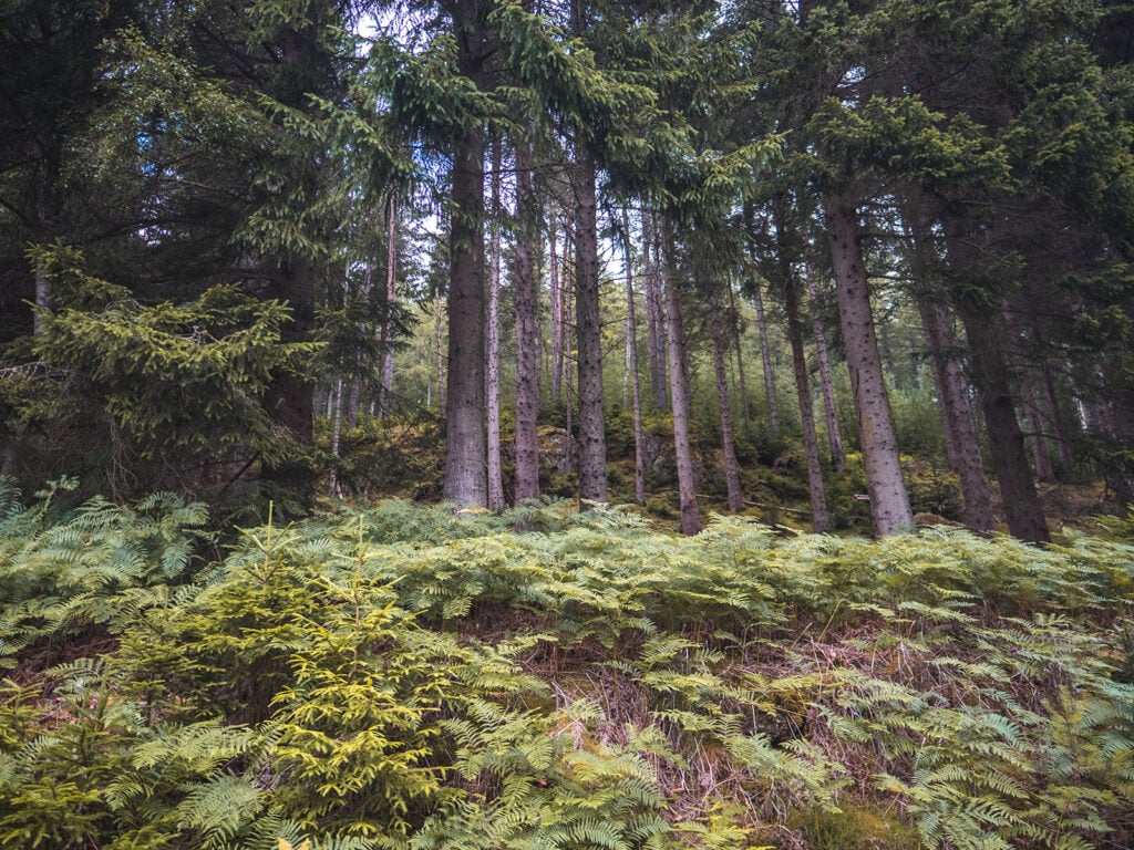
This is the shortest of the three walks and takes you through the dense forests of Drummond Hill. There is plenty of shade and opportunity to see a range of tree types.
One of the biggest draws of this walk is the potential of hearing or even seeing an elusive capercaillie, though they normally only appear very early in the morning, before 6am.
Route Details
Walk Distance: 2.5 miles / 3.9 km
Walk Time: 90 minutes
Walk Difficulty: Moderate
Path Quality: Good
Walk Description: A circular walk from the car park which takes you uphill through the forest before looping back down to the starting point.
Terrain Description: A combination of gravel and earth paths. The paths can get narrow and muddy in places. Much of the walk is uphill on moderate slopes.
Download Maps: GPX Track
Disclaimer: These GPS files are provided free-of-charge for personal use only and may not be uploaded elsewhere. By downloading you acknowledge that walking can be dangerous and this GPS data is provided without any warranty and you absolve this website for any liability.
2. Black Rock Trail
My favourite of the three trails which takes you zigzagging through the dense forest to the Black Rock Viewpoint, yielding superb views of Loch Tay and Kenmore village. There are a lot more uphill slopes to tackle than the Taymouth Trail but the views at the top make the walk well worth the extra effort.
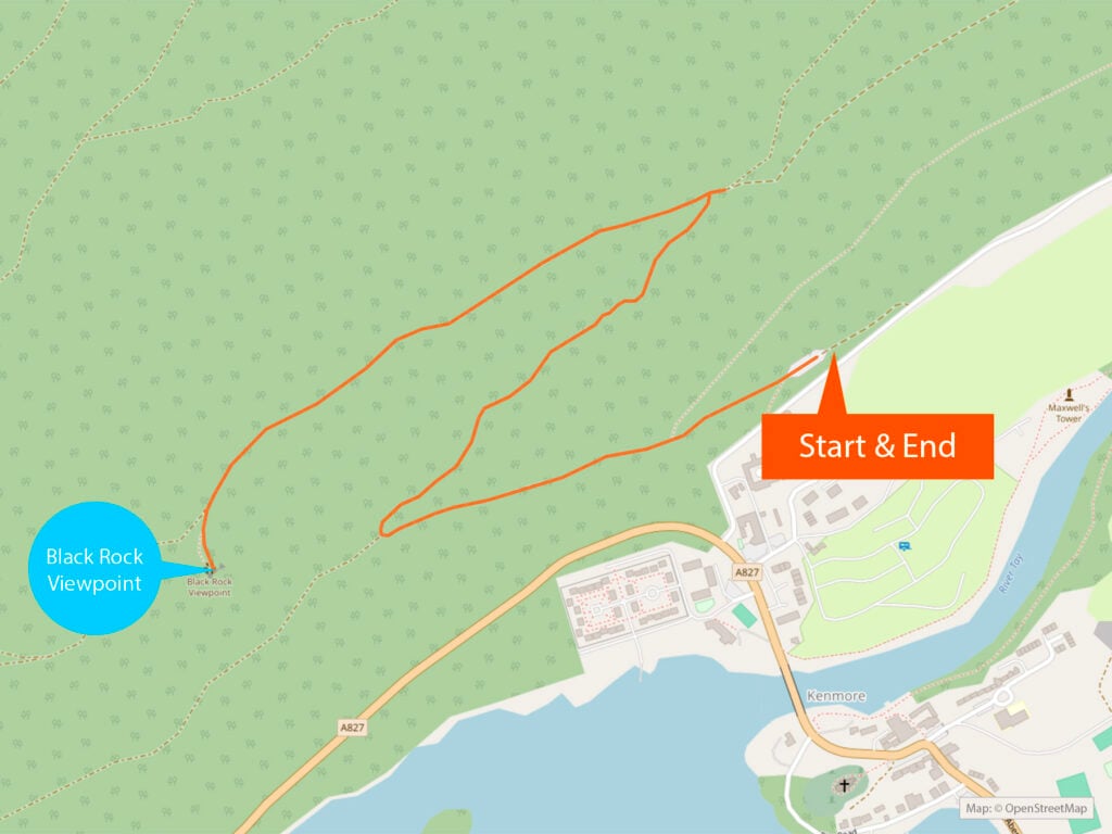
Route Details
Walk Distance: 2.75 miles / 4.5 km
Walk Time: 2 hours
Walk Difficulty: Strenuous
Path Quality: Good
Walk Description: This walk takes you uphill through the forest for over a mile, covering stretches of steep slopes until at last you reach the Black Rock Viewpoint, a viewing platform with arguably one of the best panoramic views in the area. The walk will then take you back down the same path to the walk’s starting point.
Terrain Description: A combination of gravel and earth paths. Over a mile of the walk tackles a steep uphill slope.
Download Maps: GPX Track
Disclaimer: These GPS files are provided free-of-charge for personal use only and may not be uploaded elsewhere. By downloading you acknowledge that walking can be dangerous and this GPS data is provided without any warranty and you absolve this website for any liability.
3. Caisteal MacTuathal Trail
For the more adventurous hikers, this trail incorporates the Black Rock Trail and journeys onwards, to the top of Drummond Hill where you will encounter the remains of an Iron Age Fort as well as a striking viewpoint of Strathtay and Glen Lyon.
Unlike the other two trails where you follow coloured wooden markers, for this trail you follow stone bear carvings, making the trail feel magical.
Warning! Caisteal MacTuathal trail was closed at the time of writing this guide due to windblown trees over the path. Check here for updates on this closure.
Route Details
Walk Distance: 5.75 miles / 9.4 km
Walk Time: 4 hours
Walk Difficulty: Strenuous
Path Quality: Moderate
Walk Description: This circular walk takes you up the same uphill trail as Black Rock Viewpoint. But instead of turning back after the viewpoint, continue upwards, zigzagging through the forest until you reach the remains of an Iron Age Fort at the top, just before the viewpoint of Strathtay and Glen Lyon. The trail then heads downhill, taking you back to the car park.
Download Maps: GPX Track
Disclaimer: These GPS files are provided free-of-charge for personal use only and may not be uploaded elsewhere. By downloading you acknowledge that walking can be dangerous and this GPS data is provided without any warranty and you absolve this website for any liability.
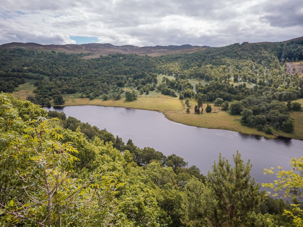
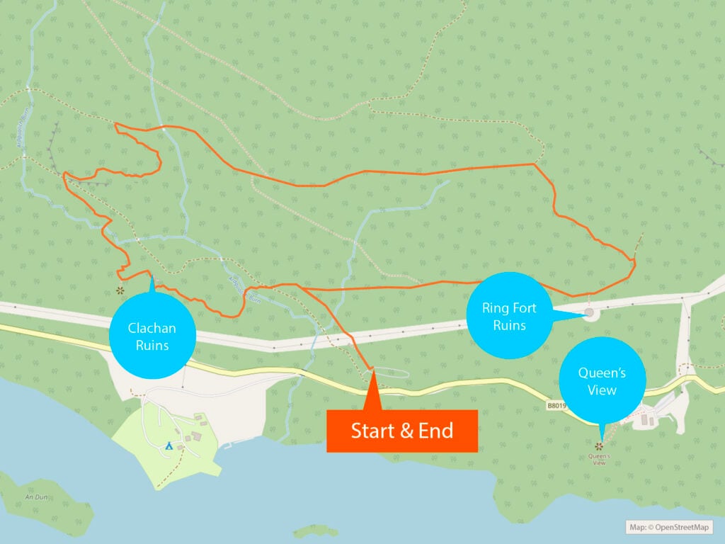
Allean Forest Walks
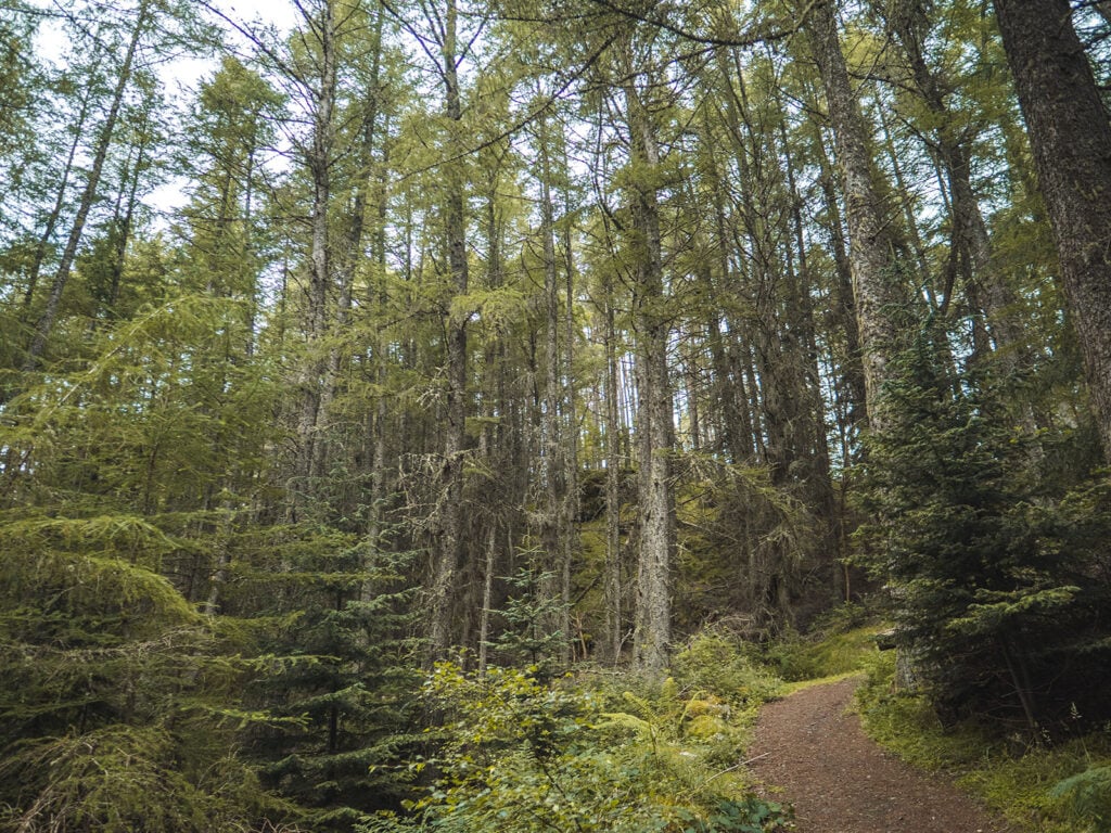
Not far from the stunning Queen’s View is the start to the two Allean Forest walking trails, which take you through the peaceful Allean Forest. Allean Forest is home to some of the largest trees in the country which tower at hundreds of feet in height.
Like much of Scotland, Allean Forest is actually a restored forest, conifers sown after the generations of farmers moved out. Each tree that has been planted has been carefully matched to its ideal soil type.
Capercaillies call this forest home. Visit between March and July which is capercaillie mating season. If you’re lucky you may be able to hear their courtship displays.
Free parking is available at the start of the walking trails.
To find the car park, from the A9 follow signs for Killiecrankie, then to Kinloch Rannoch. Allean car park is located on the right, 7.5 miles along the B8019 and just under half a mile after the Queens View Visitor Centre.
There are toilet facilities at the start of the trail.
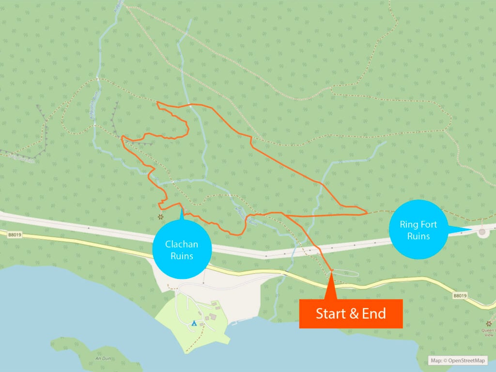
1. Clachan Trail
This walk takes you deep into the forest with some gradual uphill slopes. You’ll find yourself surrounded by towering conifer trees, with nothing but the serene birdsong to disturb the silence.
On this trail you will find the abandoned farming settlement of Clachan, which has remained untouched for two centuries. Bring a torch so you can have a peek inside the largely intact remnants of one of the buildings.
Most of the walk is through forest canopy, with the usual caveats of uneven ground and mud after poor weather.
Route Details
Walk Distance: 1.75 miles / 3.0 km
Walk Time: 1 hour
Walk Difficulty: Moderate
Path Quality: Good
Walk Description: This circular walk takes you deep into the forest, gradually ascending uphill. About a quarter in, you will come across the ancient ruins. Continue meandering through the great forest. Eventually you will meet a gravel path and begin your descent.
Terrain Description: A combination of grassy paths, wooden bridges over streams and a wide gravel track. There is an uneven grassy section which can get muddy. Some slopes are pretty steep.
Download Maps: GPX Track
Disclaimer: These GPS files are provided free-of-charge for personal use only and may not be uploaded elsewhere. By downloading you acknowledge that walking can be dangerous and this GPS data is provided without any warranty and you absolve this website for any liability.
2. Ring Fort Trail
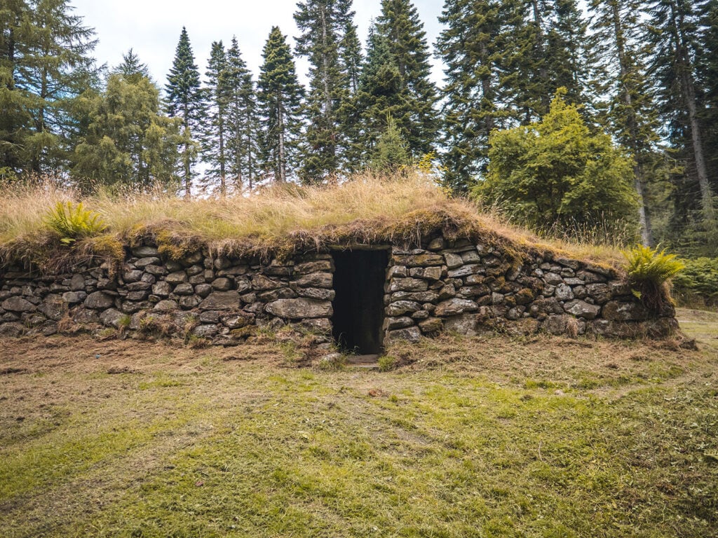
This trail incorporates much of the shorter Clachan Trail, including a stop at the abandoned farming settlement of Clachan. The trail however continues on for longer, including the remains of a Pictish homestead known as the Ring Fort that is a thousand years older. On sunny days you may even spot an adder or two bathing on the stones of the fort.
Listen out for the beautiful calls of goldcrests, siskins and Scottish crossbills in the thick leafy canopy overhead.
Route Details
Walk Distance: 2.5 miles / 4.0 km
Walk Time: 90 minutes
Walk Difficulty: Moderate
Path Quality: Good
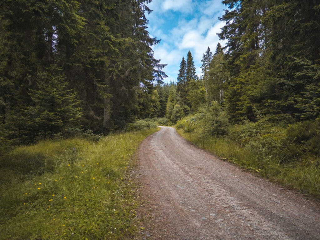
Walk Description: This circular walk takes you into the forest, following the same trajectory of the Clachan Trail for half of the walk. You will pass the ancient ruins of Clachan before continuing through uphill the forest. When on the well-used forest road, continue along it where the Clachan Trail veers away. Eventually you will leave the road and come across the mysterious Ring Fort. The remainder of the walk is on a relatively flat gravel path.
Terrain Description: A combination of wide gravel paths and small wooden bridges over streams. Some of the paths are uneven and grassed over in parts.
Download Maps: GPX Track
Disclaimer: These GPS files are provided free-of-charge for personal use only and may not be uploaded elsewhere. By downloading you acknowledge that walking can be dangerous and this GPS data is provided without any warranty and you absolve this website for any liability.
Faskally Walks
Faskally offers amongst the easiest walks within the Tay Forest Park. Both trails begin at Faskally House, a few miles north of Pitlochry, and you can park your car there for free. It is signposted ‘Faskally’ on the B8019 north west of Pitlochry. From there you have two options for walking.
1. Dunmore Trail
Taking a little under an hour, this 1.2 kilometre walk is all on the flat level and so is suitable for wheelchairs and pushchairs too. There are a couple of easily navigable slopes. The route takes you around the edge of the loch and its boathouse, as well as through some easily walkable forest with towering trees.
2. Foresters’ Trail
This walk is around the model forest which surrounds Faskally House and takes around an hour to cover two and a half kilometres. It is not a strenuous walk, but nevertheless does involve some slopes and some wooden steps which can get wet in the autumn and winter. It also weaves past Faskally Loch and provides a nice mix of scenery between forest and placid lake.
Craigvinean Hill Walks
Craigvinean is a ‘Big Tree’ part of the Tay Forest Park and is one of the lesser used walking areas. It is just a mile from the small town of Dunkeld, and the free car park is clearly marked on the A9 once you have passed The Hermitage outside Dunkeld. There is also a paid car park in The Hermitage.
1. Torryvald Trail
This route is moderately easy to undertake, lasting under two kilometres. There is a good and well-marked path through the forest, though there are a couple of relatively short bursts of uphill walking, and this demands a little more than basic fitness. The aim of the walk is to reach the ruined Torryvald folly, a once ornate building that has been left to nature. You step back in time when you get there.
2. Pine Cone Point Trail
A moderate to challenging walk approaching five kilometres in length, which takes up to two hours depending on fitness. Beware the steep sections that occur on the path. A giant pine cone awaits you at the end of the trail, along with a magnificent view across the river Tay and back to the pretty town of Dunkeld.
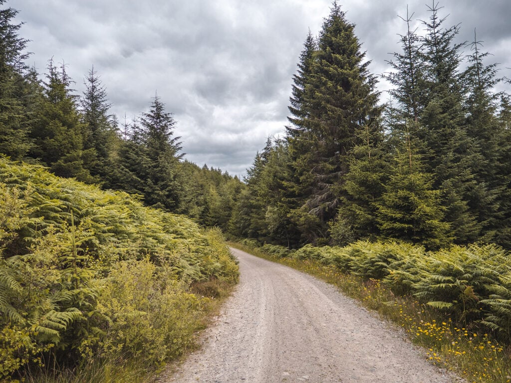
Carie, Loch Rannoch Walks
Popular with campers and including a well located campsite, you head from the village of Kinloch Rannoch to the southern road of Loch Rannoch and look for Kilvrecht Campsite. Pass the campsite and you’ll soon find the free car park, from where three different walks are available.
1. Carie Trail
A very short walk of just a kilometre that needs no serious fitness and takes maybe thirty minutes at most. There are a couple of steep slopes but you get into the forest pretty quickly and are virtually guaranteed to see birds and squirrels.
2. Kilvrecht Trail
Lasting around an hour, and encompassing some 2.5 kilometres of walking, this looped walk is partly on path and partly on forest road. You also have a few short slopes to navigate on your way. The joy of the walk is the trees and then the open expanse for the last quarter.
3. Allt na Bogair Trail
This route is moderate rather than strenuous but does last a long time, taking maybe three hours to walk the 8.5 kilometres. Most of the walk is through the forest canopy, though again some encompasses forest roads, and there are the usual steep hikes during part of your journey. The views of the valleys around and the unspoilt splendour of Rannoch Moor are a real treat.
Where to Stay in Tay Forest Park
Despite its remote and beautiful location, a strong tourist infrastructure exists in the Tay Forest Park and there are a range of accommodation options depending on price and the type of experience sought.
Tay Forest Park Camping
The Tay Forest Park has a range of different and well-respected campsites, all of which seek to be eco-friendly and extend a warm welcome to visitors.
Tay Forest Park Managed Campsites
The Kilvrecht Campsite is the largest and most well-equipped within the Park, and is easily signposted from Dunkeld to the southern bank of Loch Rannoch. It’s also relatively close to a village with a shop and a small hotel and never feels crowded. This is easily the most popular choice.
Tay Forest Park Wild Camping
As part of Scotland’s access legislation, the Land Reform (Scotland) Act 2003, you are generally allowed to camp on unenclosed land throughout the Highlands. The usual caveats apply in terms of checking by-laws and the need to behave responsibly toward your environment.
Tay Forest Park Hotels
Hotels are available within the Tay Forest Park, especially in the town of Pitlochry.
Perhaps the most famous – and most expensive – is the Atholl Palace with its turrets and towers dominating the town’s skyline.
Another old-world choice is the well-located Fisher’s Hotel in the centre of town, which has been welcoming guests since Victorian times.
For a more modern feel in Pitlochry, consider the Scotland’s Spa Hotel in Pitlochry too, with its attractive façade and beautiful swimming pool.
You can also stay in Aberfeldy at places like the Moness Resort, or take rooms at licensed premises like the Schiehallion Hotel and or the Breadalbane Arms.
A number of small guest houses exist too, especially in Pitlochry, like the Ailean Chraggan in the tiny hamlet of Weem.
Tay Forest Park Hostels
Two options leap out if you need a hostel. One is the Pitlochry Backpackers, which is usually cheaper, and is well regarded for its cleanliness and location in Pitlochry. It offers a range of private rooms plus gender divided or mixed dorms and is quite a large premises.
Alternatively, Pitlochry Youth Hostel is well regarded. It is a smaller premises, with fewer options, but has a splendid view of the town and is very welcoming.
Tay Forest Park Cycling
Cycle paths are well established in the Tay Forest Park and amongst the popular are the Dunkeld to Aberfeldy Circular on the A826 which is a journey of some sixty kilometres.
The Aberfeldy, Foss and Pitlochry route is a little shorter but is usually pretty quiet and takes you through forest roads as well as skirting the edge of lochs.
Highland Safaris in Aberfeldy sells and rents bikes for people of all abilities.
Tay Forest Park Mountain Biking
An emerging touristic highlight of the area is off-road mountain biking and there are a number of trails opening specifically for this purpose.
These include Drummond Hill, and further into the forest at spots like Birnam – which is the wood mentioned repeatedly in Shakespeare’s Macbeth.
There is also a beautiful fourteen kilometre loop around the Hermitage and the Craigvinean forest.
Tay Forest Park Weather & Best Time of Year to Visit
The Park is quite seasonal, with some elements being closed to the public due to the bad weather over the winter months. Therefore it’s best to visit Tay Forest Park between spring and autumn.
Each season has something to offer. A visit in spring gives you the best chance to spot the majestic capercaillie, whereas summer provides you with perhaps the most reliable weather and the greatest chance of timing your visit with a clear, warm day. A visit in autumn allows you to view the vibrant and verdant autumnal colours, watching the orange and red leaves spiral to the ground within the forests.
I tend to visit Scotland in summer as this provides the warmest days and lowest chance of rain (although rain still does occur quite frequently!). It’s advisable to bear the changing weather into account when you pack for your summer visit to Scotland.
It’s always advisable to check the weather forecast just before you make your visit. You can view the live weather forecast for Pitlochry and for Kenmore.
Final Thoughts
Tay Forest Park is an area of significant natural beauty in rural Scotland that is well worth a visit. Not only are there numerous walks to undertake but spectacular monuments such as Castle Menzies sit within its boundaries.
If you are spoilt for choice with what walks to complete then I would highly recommend the Black Rock trail at Drummond Hill as well as the Clachan Trail at Allean Forest. Both walks provide a unique experience, taking in some of the most beautiful parts of Tay Forest Park.
Have you been to Tay Forest Park before? What is your favourite walk?
Ellamckendrick.com is a free online resource. If you have found this website useful for planning your adventures, you can show your support by buying me a coffee. Thanks so much!

Read More Perthshire Guides
Birks of Aberfeldy & the Falls of Moness: A Visitors Guide
Falls of Acharn and the Hermit’s Cave: The Ultimate Guide
Falls of Bruar: A Walker’s Guide
The Best of Loch Tay: 6 Activities You Won’t Want To Miss!
Tay Forest Park: A Complete Visitor’s Guide
Pitlochry Dam & Fish Ladder: Everything You Need to Know
Castle Menzies: A Complete Room By Room Tour