
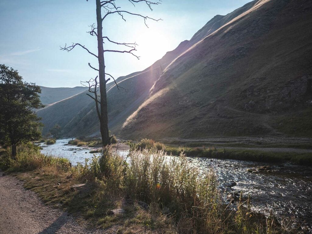
Dovedale Stepping Stones in the Peak District is arguably one of the most beautiful places I’ve visited within the UK.
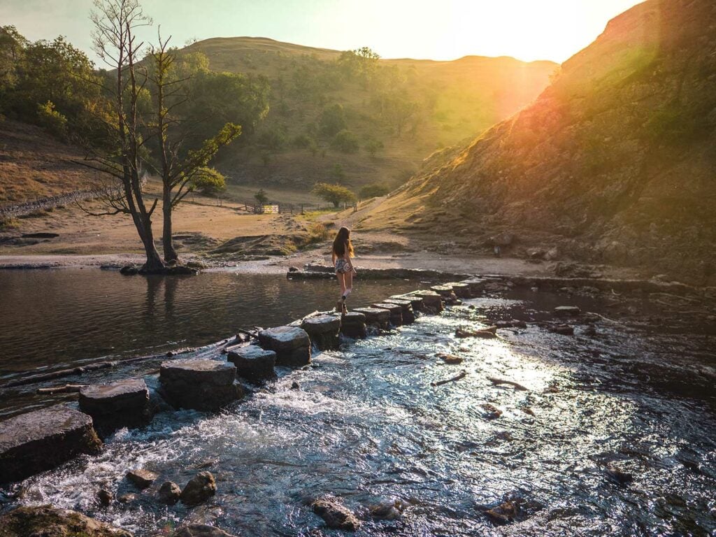
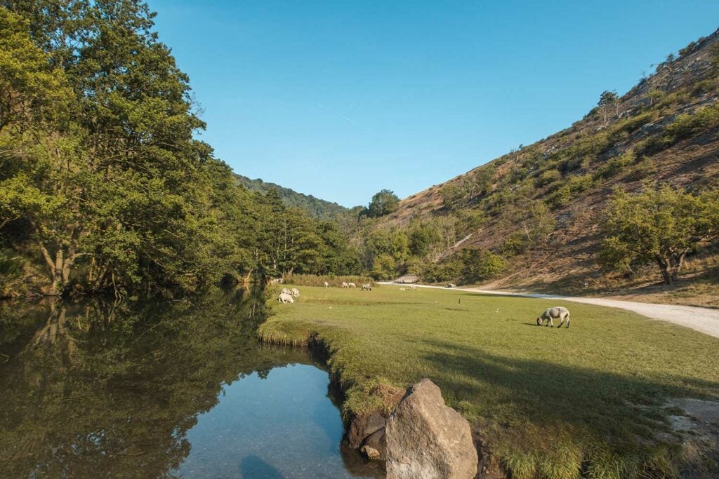
Nestled within a spectacular valley, surrounded by limestone pinnacles and ancient caves, Dovedale is an area of natural beauty that absolutely lives up to its popularity.
Whether you love hiking, fancy a peaceful picnic in picturesque surroundings, are visiting by yourself or with your family, there really is something for everyone at Dovedale.
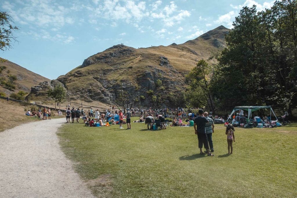
Dovedale however, is not a hidden gem. In fact it’s one of the busiest Peak District attractions and with good reason.
If you visit at the wrong time of day you will find yourself amongst crowds of hundreds of people, all bustling to get across the limestone stepping stones. It can be difficult to immerse yourself within the natural beauty of the area when your view in all directions is teeming with people.
The good news is that it is possible to avoid the crowds and enjoy the peace and serenity that the valley has to offer. Alternatively, the Chee Dale Stepping Stone walk near Buxton is a quieter but equally beautiful option at busy times such as school holidays.
In this article I aim to tell you everything there is to know about Dovedale Stepping Stones, one of my favourite places in the Peak District!
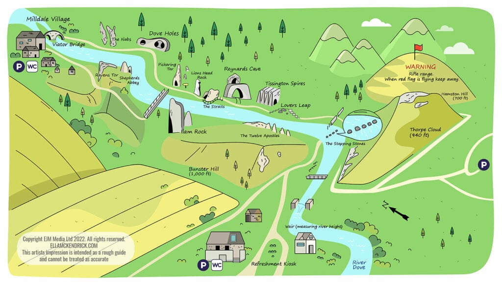
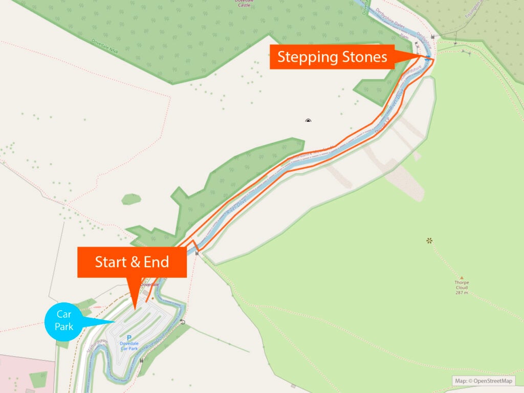
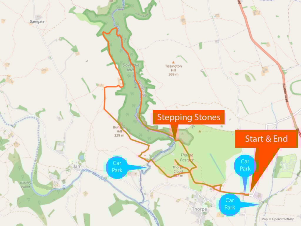
Dovedale Stepping Stones Map
Just here for the walks? Jump to the walks section to see detailed guides on my favourite Dovedale Stepping Stones walks including maps, photos, step-by-step directions and GPS files.
Dovedale Quick Facts
- Location address: Dovedale Car Park, Dovedale, Ilam, Ashbourne DE6 2AY
- Walk difficulty: Very easy
- Shortest walk length (return): 20 minutes
- Operated by: National Trust
- Dog-friendly: Yes
- Child-friendly: Yes
- Best time of year to visit: Spring or summer. Avoid periods of heavy rain when the stones may be submerged
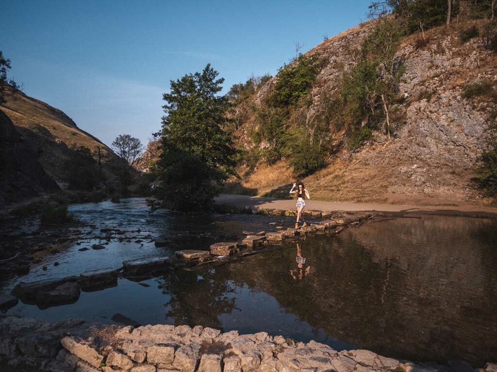
- Best time of day to visit: To avoid crowds visit early in the morning or late evening. I visited at 8am and there were very view people at the stepping stones
- Entry costs: Free
- Car park costs: £4.50 for up to 4 hours and £6 for all day. Machine only takes coins. Free for National Trust members
- Opening times: Dovedale itself is open 24/7. The nearest carpark is officially open from 9am till 7:30pm although I managed to park earlier by paying with coins in the machine
- Toilets: Yes, 20p per visit
- Food: Yes
- Top Tip: There’s no phone signal or internet so make sure you have offline maps downloaded on your phone before your walk

Table of Contents
- How were Dovedale Stepping Stones Formed?
- Are Dovedale Stepping Stones Easy to Cross?
- How Busy is Dovedale?
- Dovedale Stepping Stones History
- Is it Safe to Visit Dovedale Stepping Stones?
- Planning Your Visit to Dovedale Stepping Stones in the Manifold Valley
- Where are the Dovedale Stepping Stones Located?
- Is There Parking at Dovedale Stepping Stones and Where do you Park for Dovedale Walk?
- Dovedale Stepping Stones Opening Times
- What is the Best Time of Year to Visit Dovedale Stepping Stones?
- What is the Best Time of Day to Visit Dovedale Stepping Stones?
- Dovedale Stepping Stones Walk
- Dovedale Stepping Stones FAQ’s
- What has been filmed at Dovedale?
- Food and Drinks Near Dovedale Stepping Stones
- Places to Stay Near Dovedale Stepping Stones
- Final Thoughts
Important! Please help keep Dovedale clean and tidy. Take reusable water bottles. If you do take any food, please take all your packaging home as there are no bins
What are the Dovedale Stepping Stones in the Peak District?
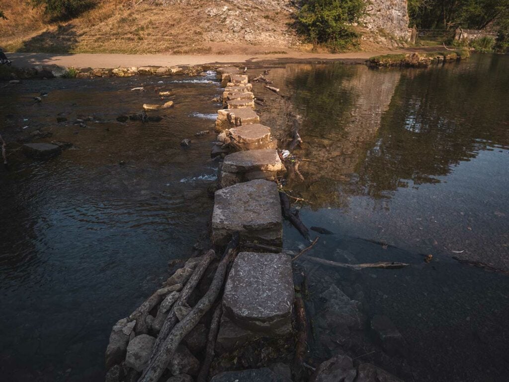
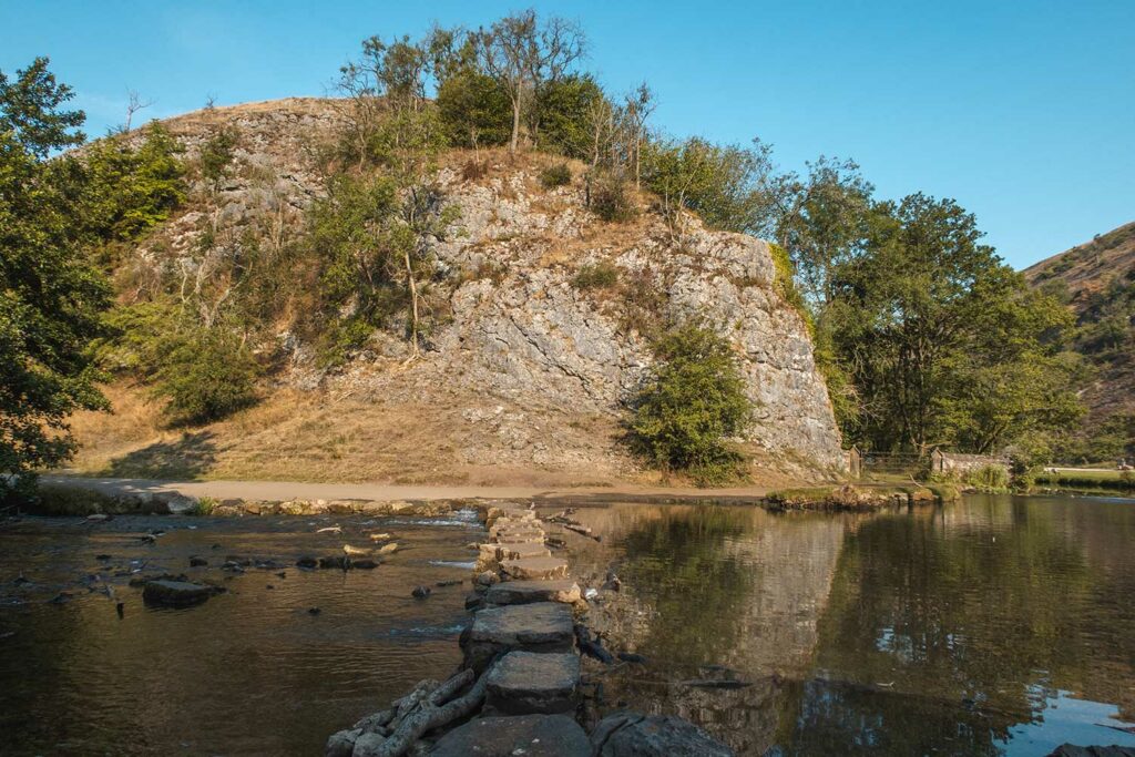
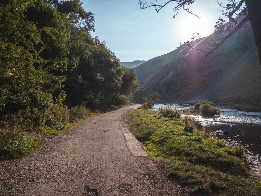
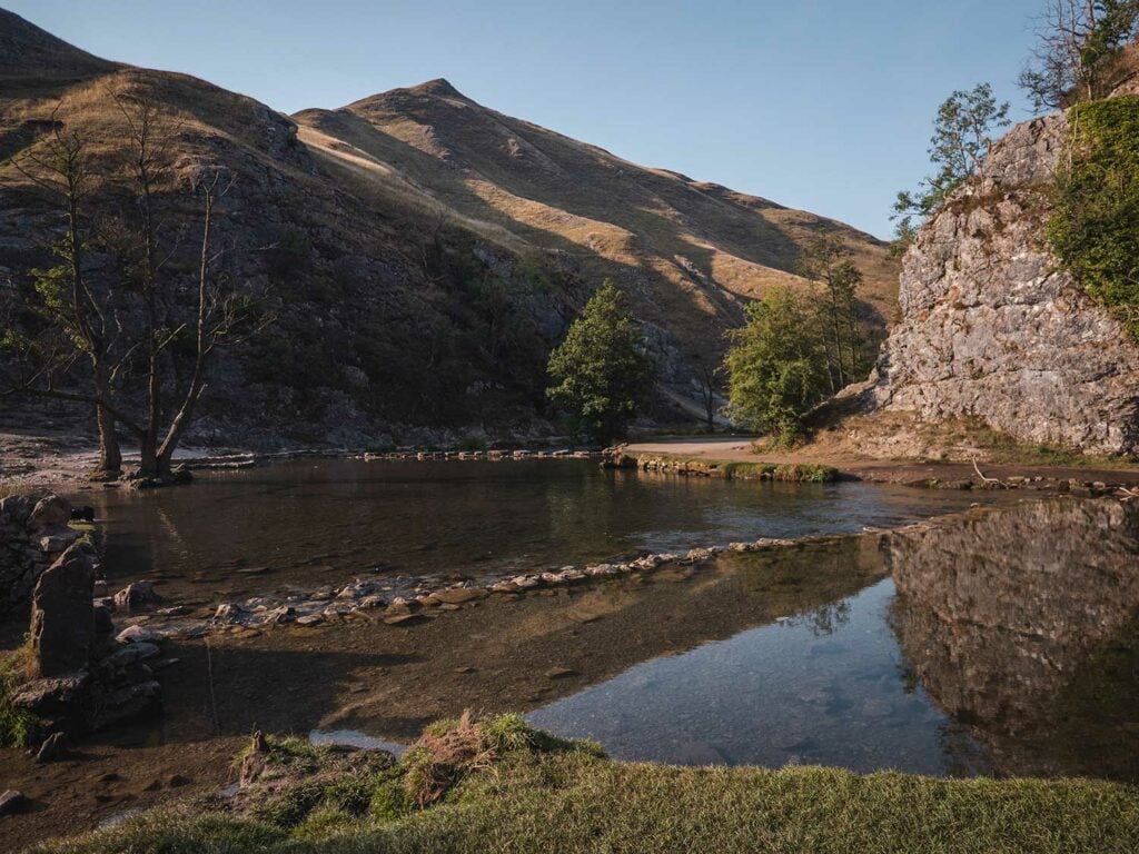
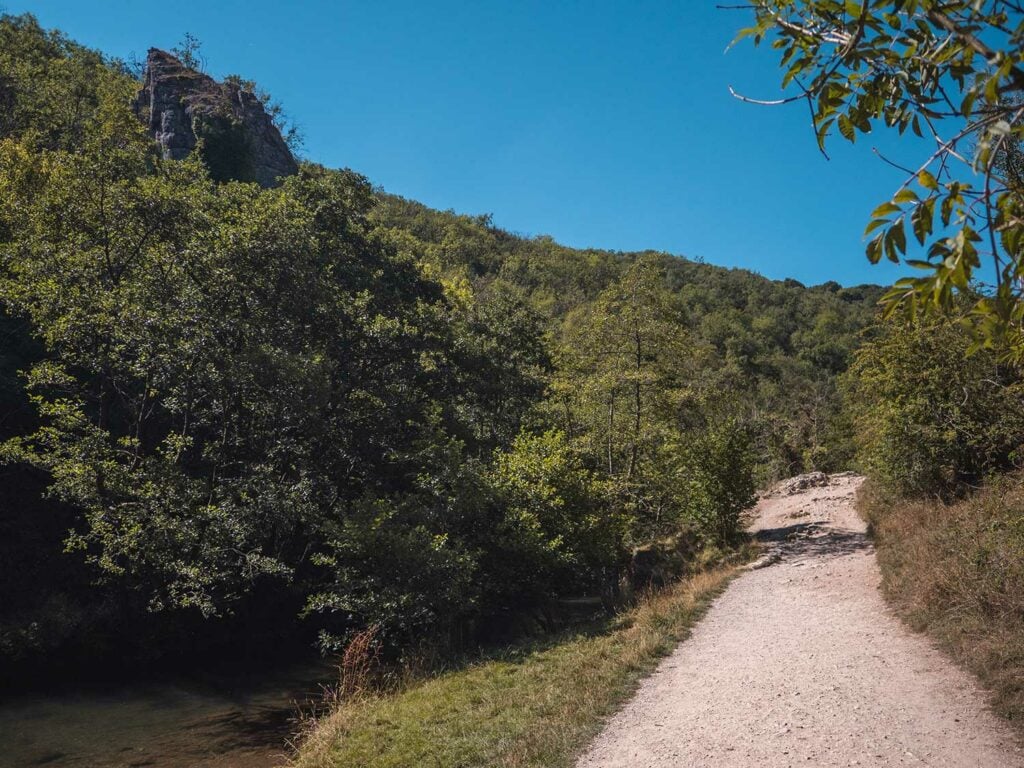
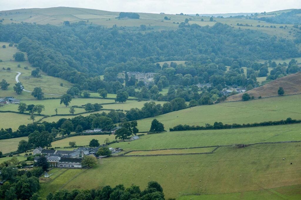
The Dovedale Stepping Stones are located in the Dove Valley within the White Peaks area in the south of the Peak District National Park. They consist of 16 limestone-capped stones which allow walkers to easily cross the River Dove.
The River Dove sits inside beautiful limestone ravines (a deep, narrow gorge with steep sides). The river divides two counties with Derbyshire on the south side and Staffordshire on the north.
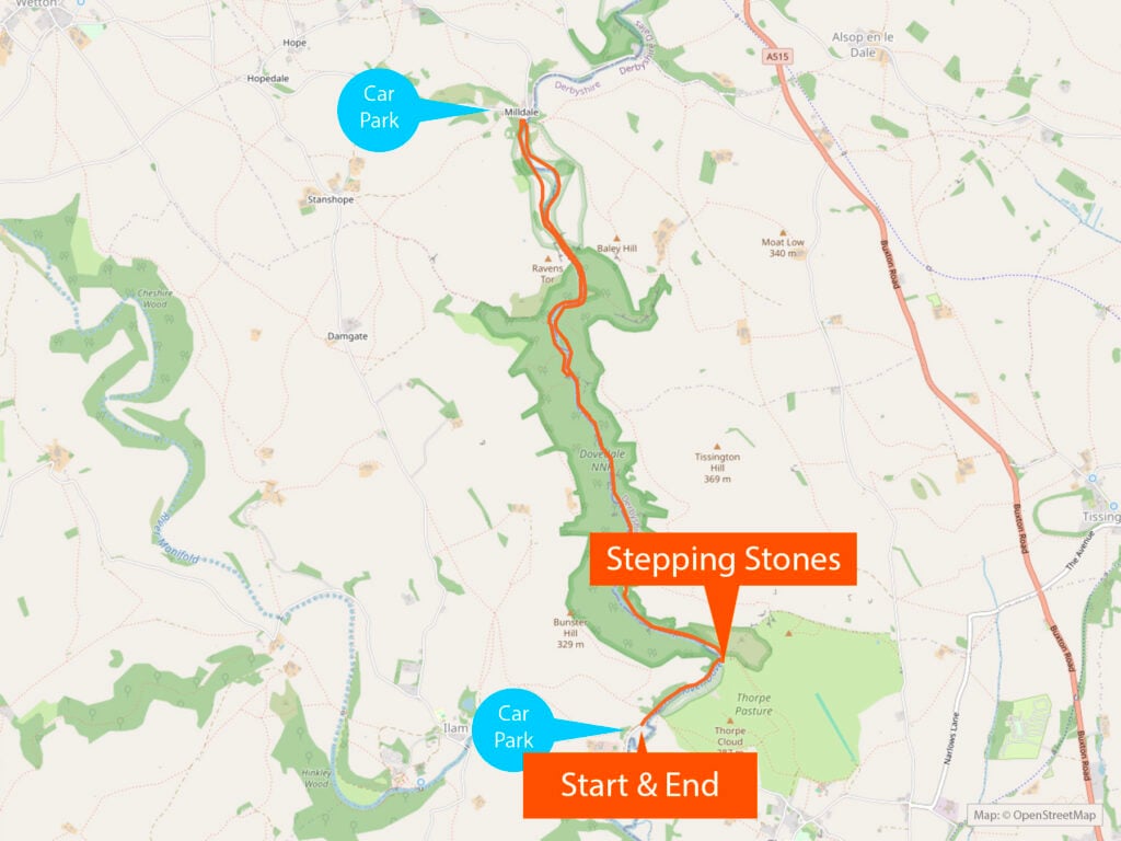
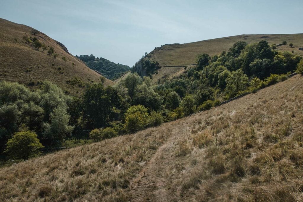
The dale (valley) spans around 3 miles (5km) between Milldale in the north and ends at a wooded ravine near Thorpe Cloud and Bunster Hill in the south
Dovedale Stepping Stones is one of the most beautiful sights in the Peak District and accessible for all ages. For this reason it can get very busy at peak times such as school holidays and in sunny weather.

The stepping stones are easy to access in 10 minutes along a flat pathway and the area provides plenty of opportunities to paddle or wild swim as well as a longer circular walk.
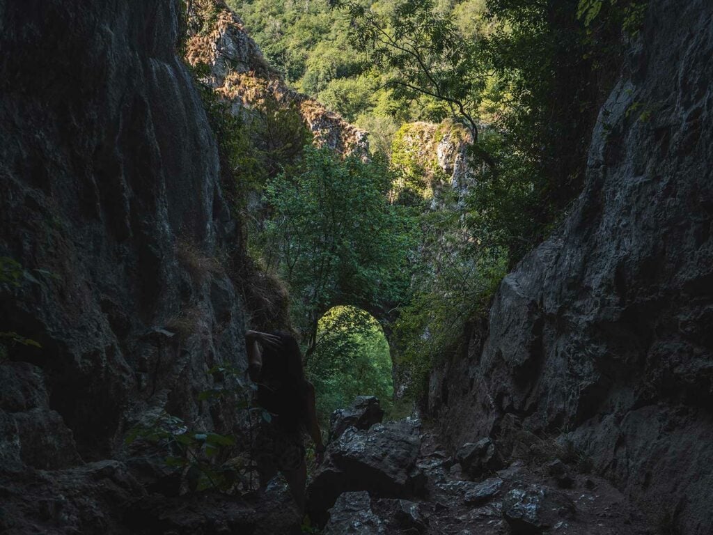
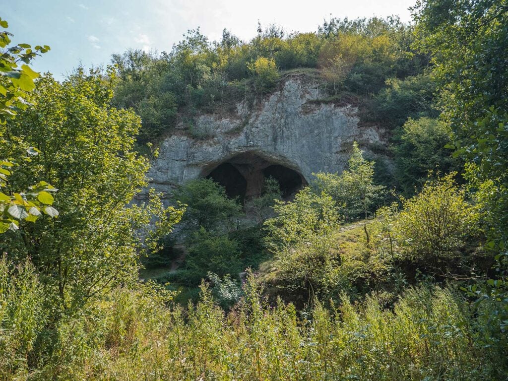
A little further past the stepping stones you can view the two ancient caves (Dove Holes).
For those more adventurous you can walk for around 1 hour past the Stepping Stones which takes you past: a couple of rock pillars including Ilam Rock, Viator’s Bridge, and Reynard’s Cave and a large limestone crag Lovers’ Leap.
You can also incorporate the Stepping stones into a walk to Thorpe Cloud, an isolated limestone hill with breathtaking views.
You are also 15 minutes by car or 3 hours by foot away from the must-see Thor’s Cave.
You may also be interested in my other Dovedale guides on Thorpe Cloud, the isolated limestone hill which overlooks the stepping stones and the beautiful stone hamlet of Milldale which sits at the north end of the Dovedale Valley.
How were Dovedale Stepping Stones Formed?
360 million years ago the entirety of the Peak District and its towering peaks was a spectacular coral reef lying undisturbed under a shallow tropical sea. Britain at that time was located near the equator, and the tropical waters were teeming with life. Shellfish, crinoids and fish all called the Peak District home.
During this time, limestone was formed. Whenever a shellfish came to the end of its life, their skeletal matter would sink to the ocean floor. Over time this matter built up to create limestone.
Over the next 50 million years, sea levels began to deplete as a result of a great buildup of ice on the supercontinent of Gondwana. It reduced the amount of water in the oceans, causing a global drop in sea level. The Peak District emerged from the ocean and became exposed to erosion and weathering.
As the water levels went down, limestone was exposed. Within the limestone one can still see the fossilised remains of sea creatures, plants and shells, evidence from the time when the valley lay underwater.
Soon the area was transformed into an extensive river delta, sand and mud being washed down the river, becoming compressed and lithified and thus forming gritstone and shale rock which today make up a large proportion of the northern Dove Valley.
At the end of the ice ages – between 2.4 million and 11,500 years ago – vast quantities of melting water from retracting ice-fields, carrying rock debris, sliced through the limestone bedrock in the Peak District, creating the steep craggy gorges which flank the Dove Valley.
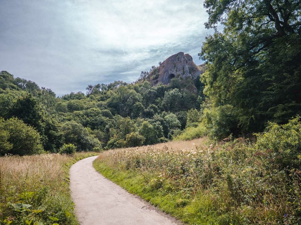
Water erosion within the cliffs formed caves such as Dove Holes and Reynard’s Cave. As the river cut deeper into the valley, the caves were left to dry.
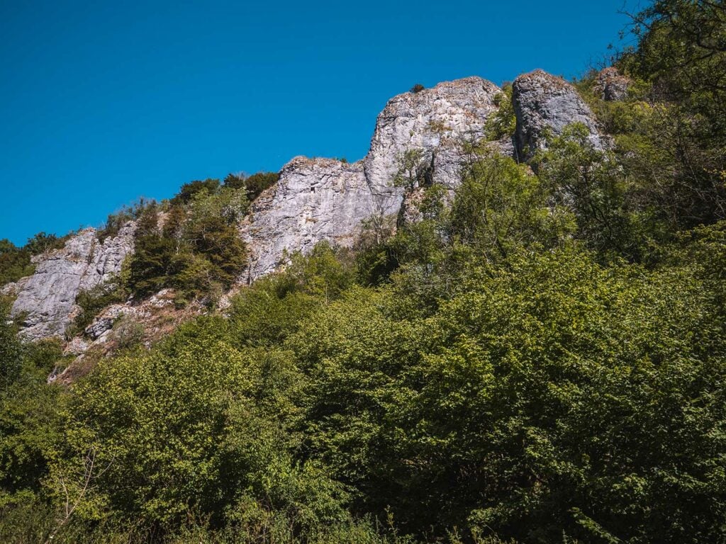
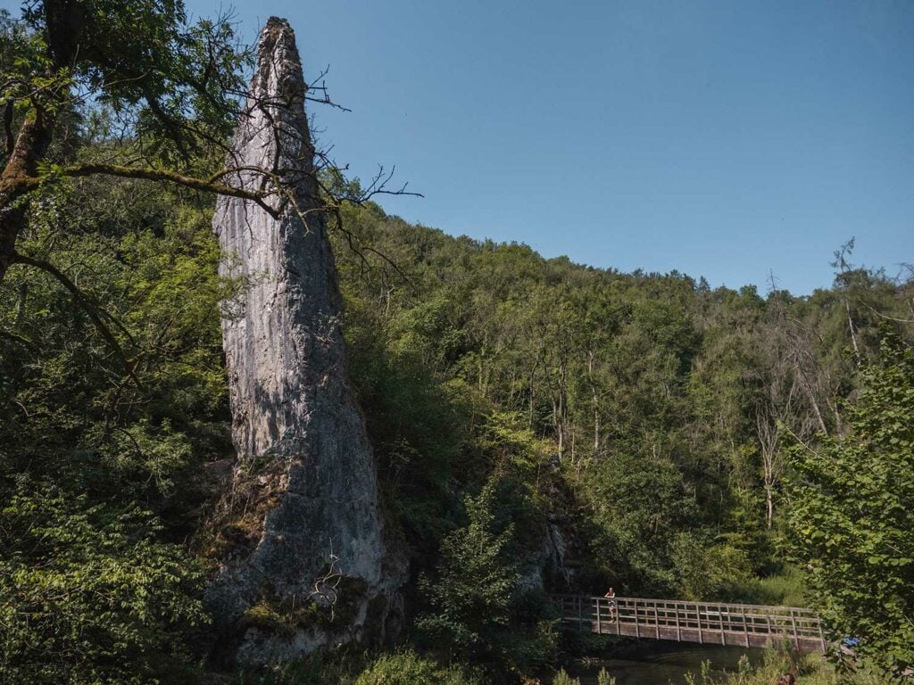
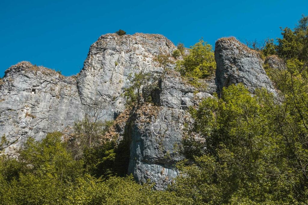
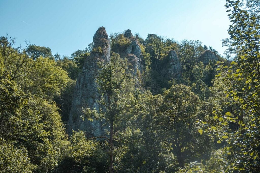
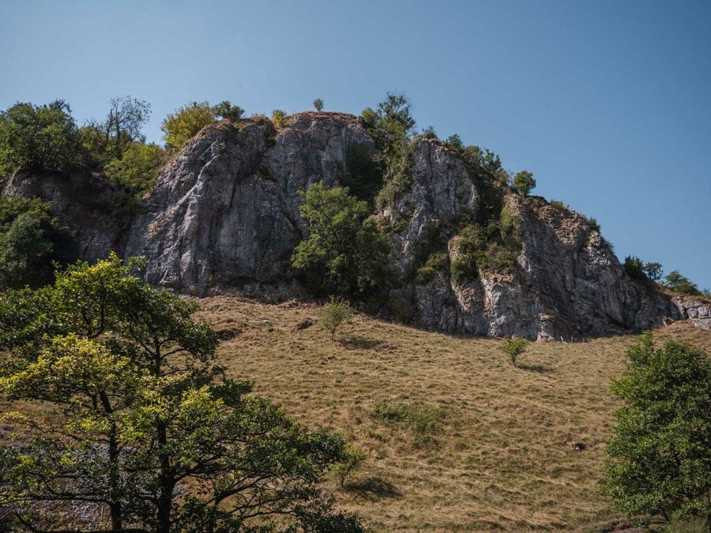
Some sections of limestone are a lot tougher than others, such as the limestone that was situated once around tropical islands. These sturdy areas of limestone have held up against weathering and have formed impressive pinnacles which protrude proudly from the forests which now coat the craggy cliffs.
Pickering Tor and Tissington Spires are great examples of this. This reef limestone can even be seen on parts of Thorpe’s Cloud.
The Dovedale stepping stones are not a naturally occurring feature in the Dove Valley. The stones were placed there by the Victorians to create an easy way to cross the River Dove. They are made up of limestone and so fossils are visible on them.
Did you know: There are four sets of Peak District Stepping Stones:
- Dovedale Stepping Stones
- Chee Dale Stepping Stones, near Buxton
- Hathersage Stepping Stones
- Bamford Mill Stepping Stones, near Castleton
Are Dovedale Stepping Stones Easy to Cross?
The Dovedale stepping stones are very easy to cross by people of all ages. Pushchairs can be carried over the stones.
Although the tar path up to the stones is wheelchair-friendly you would struggle to take a wheelchair over the steps. Dogs frequently cross the stones with smaller breeds sometimes falling into the shallow water and bounding up again un-phased.
Heavy rainfall can cause the stones to become submerged and disorganised queues can form on both sides at peak periods. See our section on best times to visit.
If you’d prefer not to cross the stepping stones, there is a bridge on your right just after the Weir (shown on our map above). The bridge does have a few steps so it’s not wheelchair friendly.
How Busy is Dovedale?
Dovedale stepping stones can get extremely busy at peak times. A high proportion of the 13.25 million people who visit the Peak District National Park, include the Dove Valley in their itineraries.
Most of the crowds at busy times are condensed around the stepping stones and the banks of the river for 5 minutes walk either side.
At peak times such as sunny weekends the car park and overflow car parks are both rammed making it hard to enter and leave. I’d recommend visiting around 8am or after 5pm on sunny weekends or alternatively parking further away and walking in.
See the car parking section and the best time to visit stepping stones for more guidance.
Below you can see photos I’ve taken at various times to show you what to expect.
I can assure you there are things in Derbyshire as noble as Greece or Switzerland.
George Byron (early 1800s) – famous English Romantic poet
Dovedale Stepping Stones History
Dovedale has a rich history beginning life as a coral reef. The earliest known use by humans was around 13,000 BCE when the caves were used by hunters for shelter. The valley has been used continuously since then.
Around 4,500 years ago the caves in the Dove Valley were used by Neolithic farmers for burying the dead. Fast forward to 2,000 years ago and the Romans used the caves as shelter for shepherds. Roman and Iron Age coins were found by a member of the public and given to Buxton Museum.
In Early Medieval times around 800 CE the Vikings inhabited the Dovedale area. Place names such as Thorpe may come from this time and are listed in the 1068 Doomsday Book.
During the The Stuart era in 1653 Izaak Walton and Charles Cotton wrote ‘The Compleat Angler’, which is one of the most famous books on fishing ever written and made the valley so famous. Izaak Walton applauded the River Dove as a pristine fishing river.
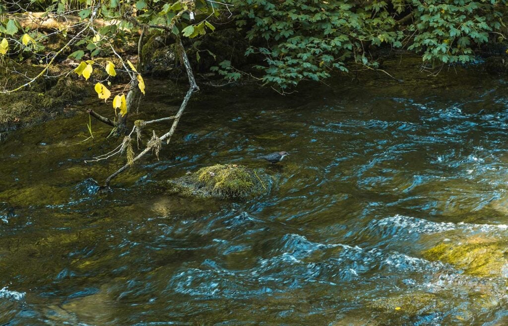
Flowing over limestones gives the Dove its unparalleled purity, making it perfect for trout and other fish.
Charles Cotton’s Fishing House which still stands on private ground on the bank on the River Dove in Beresford Dale, acted as inspiration for the book.
Viator bridge in Milldale is named after Izaak as he called himself Viator in his books – which is Latin for “traveller”
Dovedale became a tourist spot during the Georgian period in the 18th Century. Then around 1890 the Victorians laid the original stepping stones over the river Dove as the area became more popular with tourists.
Dovedale was donated to the National Trust in 1934. And in 2006 Dovedale was declared a National Nature Reserve.
Is it Safe to Visit Dovedale Stepping Stones?
In dry weather the stones seem quite safe as long as suitable footwear is worn.
Most accident reports relate to climbing of nearby mountains but I did find one recent news report of a member of the public slipping on the stones and suffering two fractures. An off-duty first responder came to her aid and also slipped and suffered an injury.
Given the millions of visitors, the low number of reported accidents and my own experience I can confer that the Dovedale stepping stones are pretty safe when visited in good conditions and with appropriate footwear.
In 2010, The National Trust and Derbyshire County Council controversially topped all but one of the original limestone stepping stones with mortar and limestone slabs. This was to stop people slipping but caused outrage and made headline news.
Some people were angry as they felt this removed some of the character of the stepping stones and also hid the fossils visible in all bit one of the stones. Other pointed out that even if you slipped off the old stones you’d only land in the shallow water.
This is vandalism and health and safety gone mad!
An angry walker
Planning Your Visit to Dovedale Stepping Stones in the Manifold Valley
Due to the popularity of the stepping stones, planning your trip is particularly important to ensure a relaxing and stress-free trip.
Where are the Dovedale Stepping Stones Located?
Dovedale Stepping Stones are located in the Dovedale valley in the very south of the Peak District National known as the White Peak Estate.
To the north of the stepping stones is the charming hamlet of Milldale, often dubbed the most beautiful village in the Peak District. The village is owned by the National Trust.
To the south is the mighty Thorpe Cloud, an isolated limestone hill.
The location of the stepping stones offers great access to many great walks
How do you Get to Dovedale Stepping Stones?
Getting to Dovedale Stepping Stones is easy; the challenge is timing your trip to ensure parking is available. I’ll provide guidance on this to ensure your trip runs smoothly.
Getting to Dovedale Stepping Stones by Car
Most visitors arrive at Dovedale valley by car. The last 10 minutes of the drive involves some quite narrow roads where you’ll need to pull over in the passing spots to let cars pass.
If you go at the right time there are hardly any other cars on the road. However, srrive at peak time and it can be quite challenging, especially for wider cars.
Is There Parking at Dovedale Stepping Stones and Where do you Park for Dovedale Walk?
Dovedale Car Park
Dovedale Stepping Stones is provided by the National Trust. This consists of a main car park [Google Maps pin]. When this car park becomes full they divert traffic to overflow car parking to the left. When this also becomes full they put up car park full signs at the start of the Dovedale road (where you turn off Thorpe road). They still seem to let cars pass but you would have to wait for a spot along with other cars.
Costs: £4.50 for up to 4 hours and £6 for all day. Machine only takes coins. Free for National Trust Members
Opening Times: 9am till 7:30pm (I managed to park earlier paying with coins in the machine).

Ilam Park Car park
If the main car park is full or if you have a larger vehicle such as a camper van (which could struggle on the narrow road to the Stepping Stones car park) you might be wise to park at Ilam Park, A 158-acre country park owned by the National Trust. This will involve an extra 1 hour walk on footpaths to reach the stepping stones. [Google Maps pin]
Milldale Car Park
You also have the option of parking at Milldale Car Park [Google Maps pin] and walking 3 miles down the dove valley to the stepping stones. If you’re planning to do the Dovedale Stepping Stones to Milldale circular walk, this won’t actually affect total walk time.
How far From the Car Park are the Stepping Stones at Dovedale?
The Dovedale car park is 0.5 miles (10 minutes walk) from the stepping stones.
Ilam Park Car park is 1.5 miles (50 minutes walk) along farmland footpaths from the stepping stones.
Milldale Car Park is 3 miles (1.5 hours walk) along Dove Valley from the stepping stones.
Getting to Dovedale Stepping Stones by Bus
There are no public transport options which take you directly to the Stepping Stones. You can however get a bus to Ashborn and then walk to the stepping stones. The major bus operators in Ashbourne are Stagecoach Manchester, Trent Barton, and High Peak. View list of bus routes in Ashbourne here.
Dovedale Stepping Stones Opening Times
Dovedale Stepping Stones is open 24 hours a day 7 days a week as it’s a permissive pathway.
Dovedale Stepping Stones Car Park Opening times
Officially the Dovedale car park is open from 9am to 7:30pm. However, I managed to park there at 8am on my most recent visit. At that time there were no National Trust staff present so I used the ticket machine.
Is Dovedale Stepping Stones Free? Do You Need to Pay to Visit?
Visiting the stepping stones is free. However, car parking at the main Dovedale car park is £4.50 for 4 hours or £6 for all day or free for National Trust members. National Trust members can either visit the kiosk for a parking ticket or else leave their membership card on the dashboard.
Should you Visit Dovedale Stepping Stones Independently or via Tour?
Most visitors including myself visit the stepping stones independently.
There don’t appear to be any group guided tours of the stepping stones. However, you can book private tour guides for the peak district and include stepping stones in your itinerary.
What is the Best Time of Year to Visit Dovedale Stepping Stones?
The perfect time of year to visit Dovedale is any period which has good weather but ideally avoiding busy periods such as weekends and public holidays if you can.
School holidays are also best avoided where possible. Visiting at a quiet time allows you to have a more authentic experience with fewer tourists to truly immerse yourself in nature and experience the incredible beauty of the Dovedale valley.
Rainy weather will make some parts of the walk more tricky and during periods of very heavy rain the stepping stones can become submerged.
What is the Best Time of Day to Visit Dovedale Stepping Stones?
Short answer: arrive early, before 9am.
On busier days such as sunny weekends and public holidays, the carpark starts to become busy at 9am and can completely fill up by 10am.
I visited on a sunny weekend at 8am and there were around 10 cars in the car park. There were few enough people that I was truly able to enjoy the scenery and ambience of the valley. Something which I’d not really been able to do on my previous visit mid-day on a weekday during school holidays. I’ve not yet tested visiting later but I’ve been told that it becomes quieter again at around 5pm.
When the stepping stones are quiet you have a very different experience and are able to fully appreciate the beauty and sounds of the valley in a way which is not possible during busy periods.
Dovedale Stepping Stones Weather
Dovedale stepping stones are best visited on a dry day. I recommend checking the weather before departing here Met Office Weather for Dovedale and here BBC Weather for Dovedale
During periods of prolonged heavy rain the Stepping Stones can become submerged. You can check the current river levels on River Dove at Izaak Walton here.
Dovedale Stepping Stones Walk
Dovedale offers walks to suit everyone from a short 10 minute stroll to a full day adventure. Below I’ve laid out the most popular Dovedale walks so you can choose which one is right for you.
Walks in This Guide
- Easiest and Quickest Walk (20 minutes)
- Dovedale Stepping Stones to Milldale Circular Walk (3 hours)
- Dovedale to Thorpe Circular Walk including Thorpe Cloud and Bunster Hill (4 hours)
- Dovedale to Ilam Park Circular walk (3 hours)
- Dovedale to Thor’s Cave Walk (6 hours)
Quickest and Easiest Walk Route to Dovedale Stepping Stones
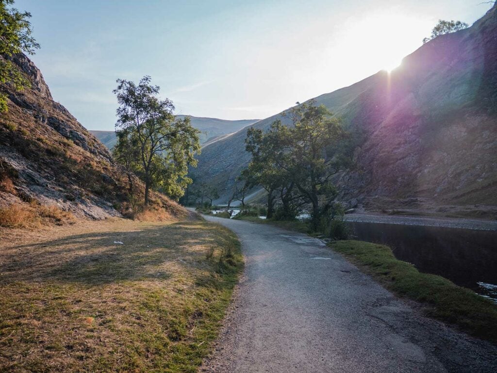
The quickest and easiest route is to simply walk directly to the stepping stones from the carpark. From Dovedale car park you can take the level tarmac path along the river Dove to the stepping stones. This is 0.4 miles and only takes 10 minutes to walk.
Route Details
Walk Distance: 0.4 miles
Walk Time: 20 minutes there and back (10 minutes each way)
Walk Difficulty: Easy
Path Quality: Very good
Walk Description: A walk from Dovedale carpark to the Dovedale Stepping Stones, alongside the River Dove with views of the mighty Thorpe Cloud.
Terrain Description: A wide tarmac path which stays at the same elevation throughout. Wheelchair and pushchair friendly (although the stepping stones themselves are not wheelchair friendly).
Download Maps: GPX Track for maps.me
Disclaimer: These GPS files are provided free-of-charge for personal use only and may not be uploaded elsewhere. By downloading you acknowledge that walking can be dangerous and this GPS data is provided without any warranty and you absolve this website for any liability.
Dovedale Stepping Stones to Milldale Circular Walk
If you’re feeling a little more adventurous, I would highly recommend the full circular walk to Milldale. This walk is packed with hidden gems including the unforgettable Reynard’s Cave and the spectacular Dove Holes.
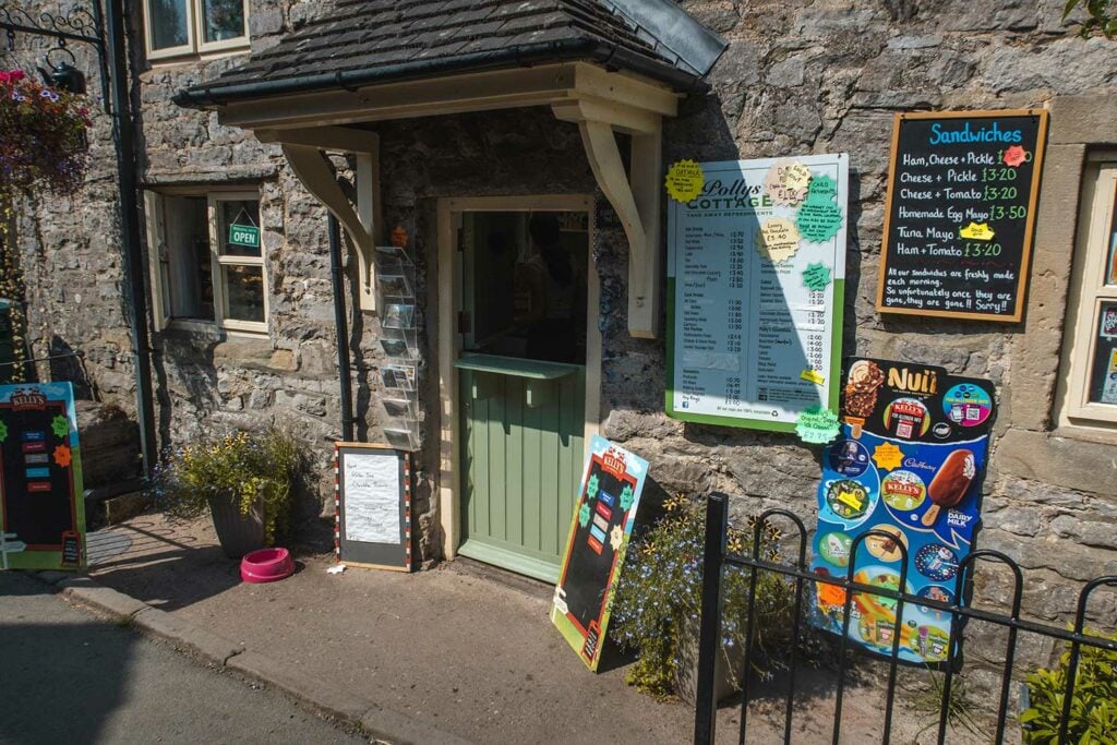
At the furthest point of the walk you travel over the famous Viator Bridge into the tiny stone village of Milldale, arguably the prettiest village in the Peak District where you can grab refreshments at Polly’s Cottage takeaway-cafe [check opening times here] and eat by the river dove.
Best of all, most people don’t venture much beyond the stepping stones so 5 minutes into this walk you start to lose the crowds.
Route Details
Walk Type: Circular
Walk Distance: 6 miles
Walk Time: 2.5-3 hours
Walk Difficulty: Moderate
Total Ascent: 611 m/2,004 ft
Highest Point: 312 m/1,023 ft
Walk Description: A circular route around Dove Valley, starting at Dovedale carpark. The route takes you parallel to the River Dove and passes a number of notable landmarks from the stepping stones to caves to limestone pinnacles. The midway point is in the quaint village of Milldale.
Walk Highlights: Stepping Stones, Lovers Leap, The Twelve Apostles, Tissington Spires, Reynards Cave, The Straits, Lion’s Head Rock, PIckering Tor, Sheapods Abbey, Dove Holes, Ravens Tor, The Nabs, Viator Bridge, Milldale Village
Terrain Description: A combination of a wide tarmac track, wide gravel tracks, stone steps, steep ascents on loose earth (such as to reach Reynard’s Cave), unpaved and uneven trails through undergrowth and over hills.
Download Maps: GPX Track
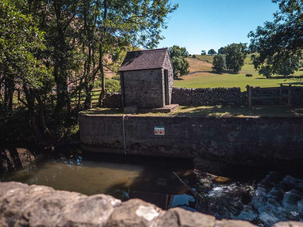
Stage 1: The Weir
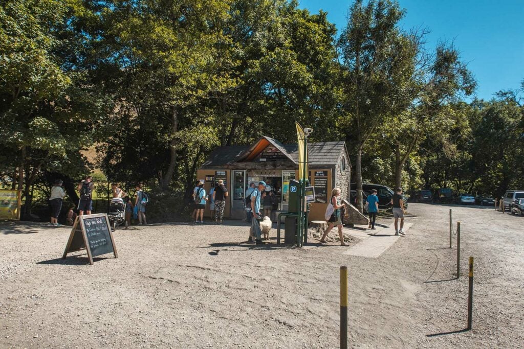
From the Dovedale Carpark, head in the direction of the refreshment kiosk. You are probably going to need some water if you’ve not already packed some and if you’re me some ice cream too!
Continue straight ahead past the Kiosk on your right, follow the tarmached path along the left of the river to the Weir which is used to control the flow of water and thus river level.
Stage 2: The Stepping Stones
You now have a choice, you can continue straight on down to the Stepping Stones with the River Dove on your right and Bunster hill on your left. This takes around 5 – 10 minutes. Once you reach the stepping stones cross over to the other side of the River Dove.
Alternatively, If it’s busy and you don’t want to queue to cross the stepping stones you can cross the river Dove beforehand by taking a right over the bridge straight after the Weir and immediately before the Dovedale Information Barn (Open easter until late Sept).
Turn left after the bridge and follow the path alongside the right of the river. After 5 – 10 minutes you will see the famous Stepping Stones.

Stage 3: Lovers Leap
After the Stepping Stones follow the path round to the left and through the gate in the old stone wall which crosses the path.
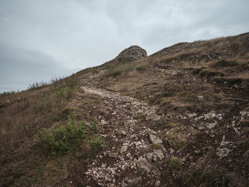
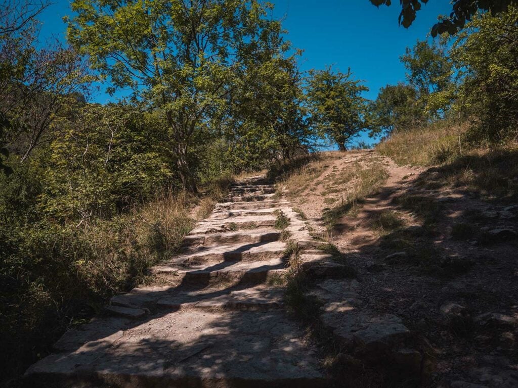
Continue along the path and make your way up the limestone steps which were built by Italian prisoners of war during WW2. At the very top of the steps, on your left you will see a grassy spur known as Lovers Leap.
Lover’s Leap is said to be named after an event which happened nearly 300 years ago during the Napoleonic Wars.
A young woman hearing that her lover had been killed, tried to commit suicide by throwing herself off the edge of the cliff. Her billowing skirt got caught on the branch of a tree and she was able to scramble to safety. She later found that her boyfriend had survived and returned to England and thus they were reunited.
According to folklore
Derbyshireuk.net gives a different story which sounds more like the folklore surrounding the other lovers’ leap in the Peak District in Stoney Middleton. The writer may have got the two mixed up.
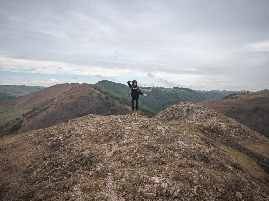
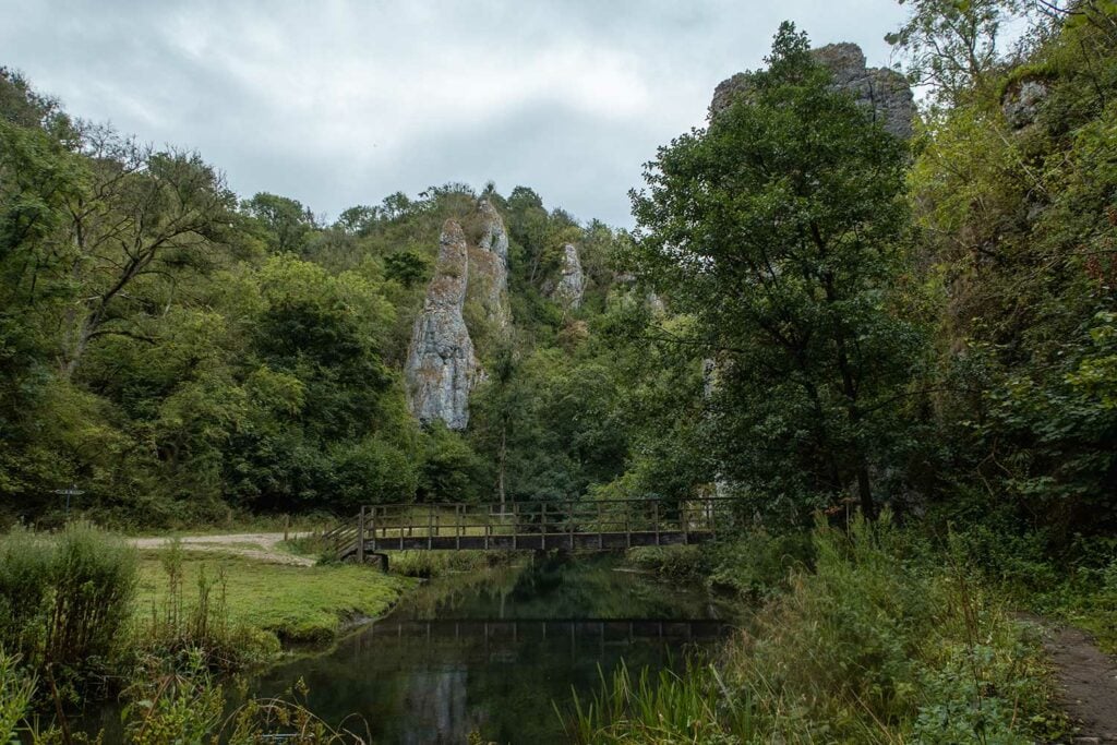
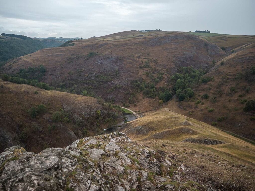
As you stand on lovers’ leap looking over the River Dove towards Bunster Hill you can see a number of impressive limestone towers and crags known as the Twelve Apostles.
The Twelve Apostles were formed from the harder reef limestone and were left standing as the rest of the valley was eroded down.
Lovers leap marks 1 mile into the walk.
Stage 4: Tissington Spires
Continue back on the main pathway into the woods and down the steps. Soon after reaching the level path again you will see the fin-like Tissington Spires jut out at the top of the Dovedale valley on your right.
Tissington Spires is popular with rock climbers and as with the Twelve Apostles, these are made of hard reef limestone.
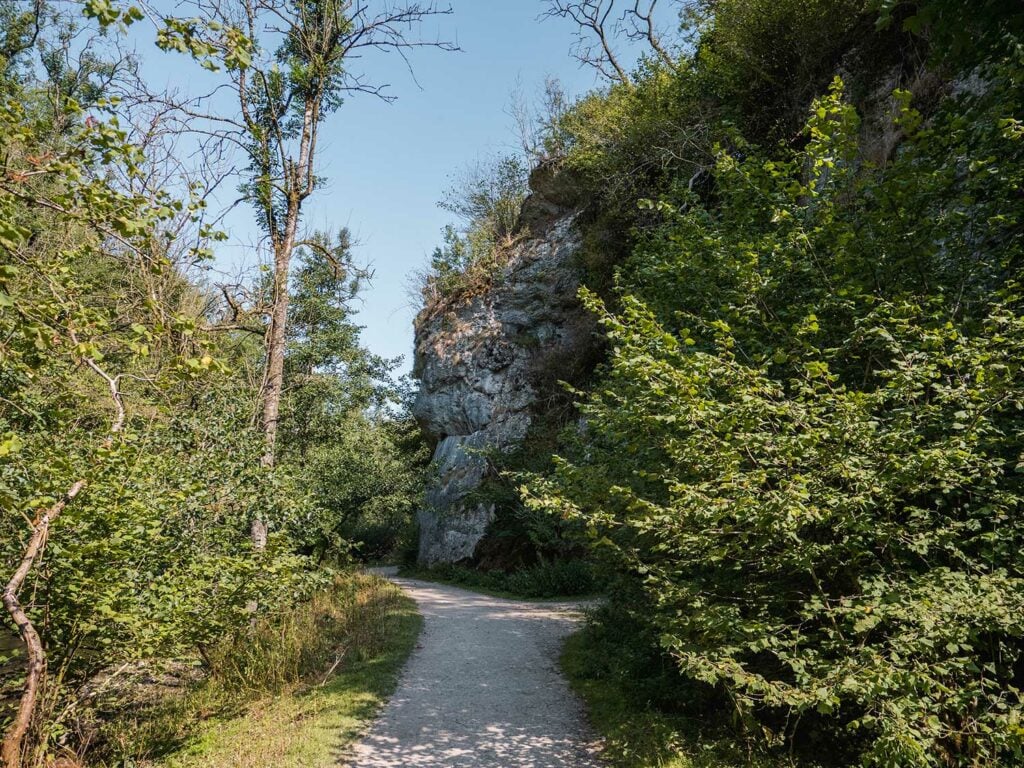
Stage 5: Reynards Cave
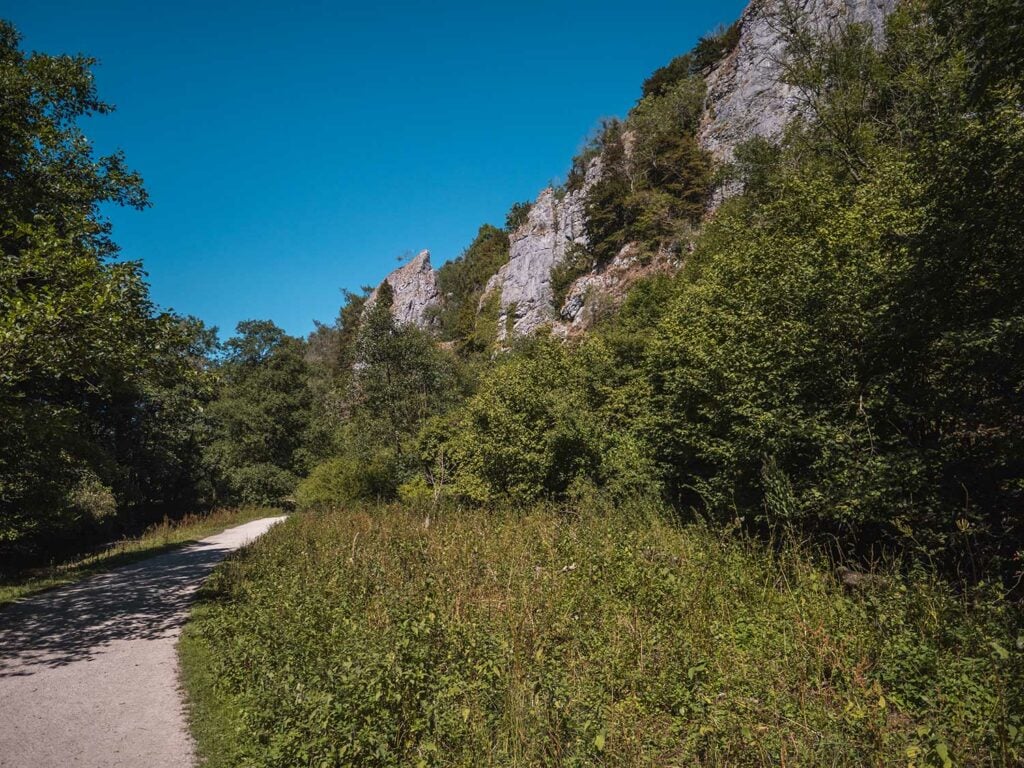
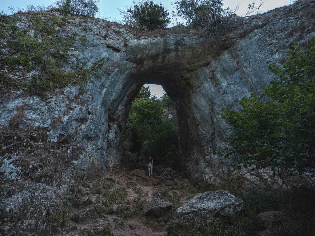
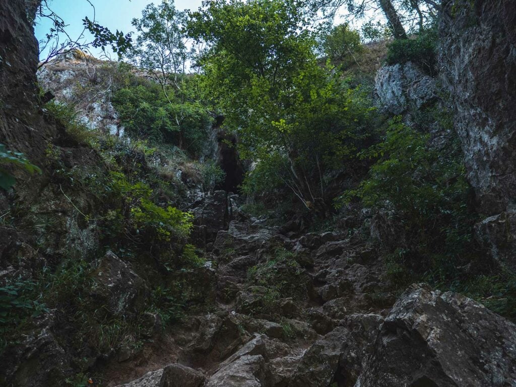
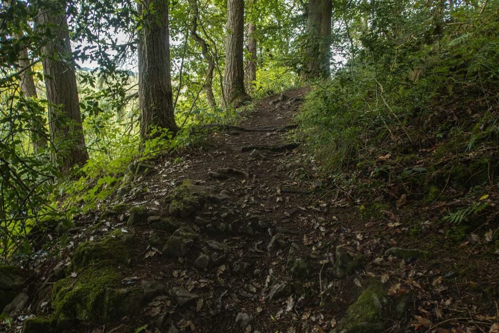
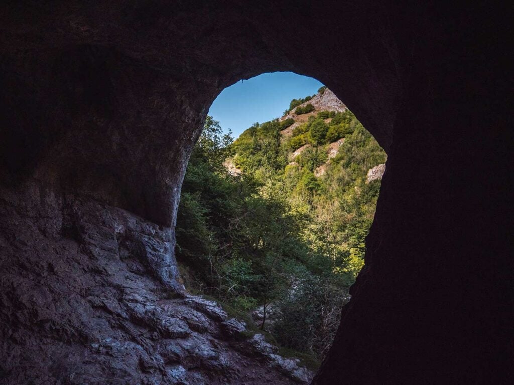
Reynard’s cave is arguably one of the most spectacular features on the walk but also the easiest to miss – I almost missed it myself on my first visit! Keep your eyes peeled for a small gravel path on the right of the track (see photo) this path takes you up to the mystical Reynard’s Cave.
First you’ll be greeted by Reynard’s arch – the original mouth of the cave before the roof fell in. Beyond that the terrain gets a little tricker (steep and rocky) but I chose to scramble beyond the arch to set sight on Reynard’s Cave and Reynard’s Kitchen cave. The view looking over the valley from the back of Reynard’s cave was more than worth the climb!
We found the easiest way to return to the path was down a narrow side-exit which is on your right as you’re coming back down before the arch. This takes you past Reynard’s Kitchen Cave.
Reynards cave was formed in the last Ice Age, around 10,000 years ago when meltwater from the glaciers increased the height of the River Dove which started flowing rapidly and violently. Freezing cold waters cut through fissures and faults in the limestone rocks. The vertical crags and pinnacles are harder bands of limestone which the River Dove could not cut through.
For thousands of years before this, Acidic rain water has been trickling into the many joints and cracks present in limestone. The acidic rain water dissolved and widened the joints into underground drainage systems including caves and tunnels.
As the river Dove cut through the limestone, it reached some of the secret tunnels and caves, opening them up for the very first time. This is how Reynards Cave was formed and exposed.
Folklore has it that this was the hideout of a local brigand called Reynard who was a member of a gang that ambushed and robbed people in forests and mountains. Another rather different myth is that it was named after foxes who used the cave as a den.
In 2014 an excavation unearthed late iron age and Republican Roman coins in Reynard’s Kitchen Cave. You can view this find in the Buxton Museum.
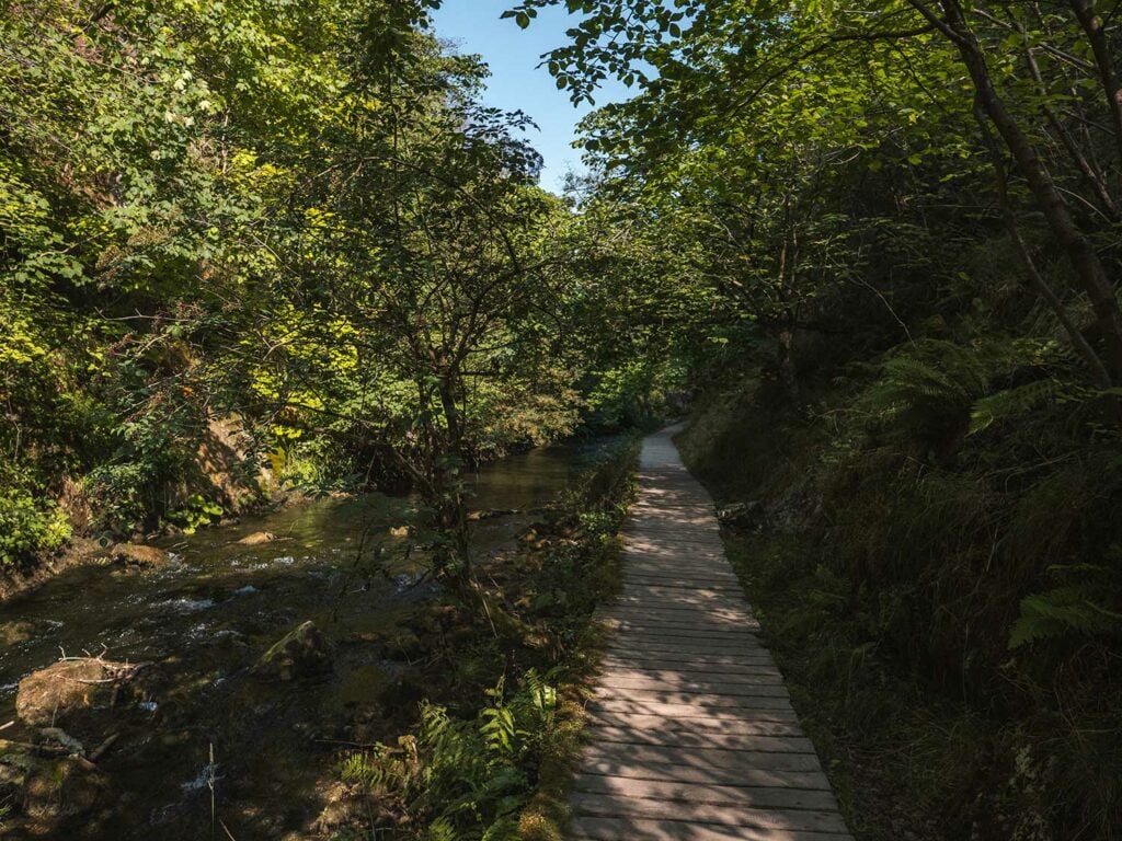
Stage 6: The Straits & Lions Head Rock
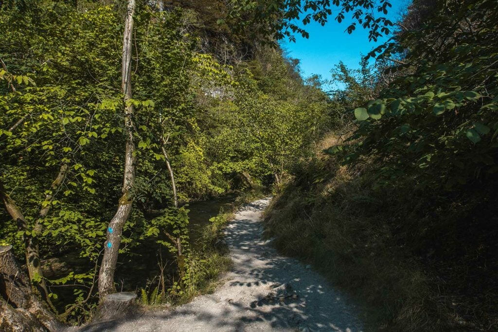
Back on the main path you’ll find it narrows as you reach a section known as The Straights. This section is often prone to flooding and has been raised on wooden boards. You’ll notice a cave with a fresh water steam on your right. As the path opens out again, you’ll pass under the famous Lion’s Head Rock jutting out from the limestone cliff on your right.
Stage 7: Ilam Rock
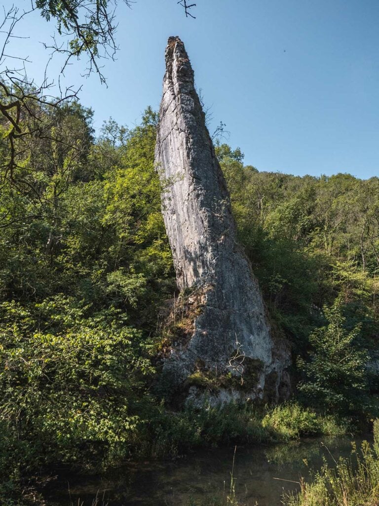
Once you catch sight of the Ilam Rock Bridge, look over to your left to behold the imposing solitary tower of rock known as Ilam Rock standing at 25m-high. Ilam rock is one of the finest rock pinnacles in the ravine. If you look closely you might spot the cave at its base.
As with the other formations, Ilam Rock was a pillar of hard reef rock left behind by the glacial waters during the last ice age.
Stage 8: Pickering Tor
Just before the bridge on your right, you’ll see the limestone rock formation known as Pickering Tor. There is a steep path veering off from the main path which leads up to a shallow cave in the base of the limestone structure.
Keep straight on the path (don’t cross the bridge – we’re going to come back that way).
You’re just shy of 2 miles into the walk at this point.
Stage 9: The Dove Holes and Shepherds Abbey
As you continue past the bridge with pickering dale on your right, the path swings round to the right. You will see a small rocky outcrop on the left of the path and then beyond that over the river dale sits Halldale and Shepherd’s Abbey rocks and caves.
As the path starts to drop downhill, you’ll be able to see one of Dovedales biggest attractions, the gigantic twin caves known as the Dove Holes. At 30ft high and 60ft wide the larger of the two dove holes, referred to as the Bat Cave by local climbers, is huge in size.
Sitting at an altitude 210m the these Dovedale caves have been used for shelter by hunters since 13,000 BCE and Roughly 4,500 years ago the caves were used as burial grounds for the dead by Neolithic farmers.
Dove comes from the Celtic word dubh meaning black which may refer to the Dove Valley or it could be referring to the dark insides of the caves.
You can climb inside the caves for spectacular views over the river to Hall Dale.
Stage 10: Ravens Tor and The Nabs
Continue back on the path and wander through a gate. You can see the limestone landscape of Nabs Dale on your right, peaks poking out from behind dense woodland. The Nabs woodland is a great example of a semi-natural, ancient limestone woodland. The woodland is rich in a variety of flora and fauna such as dogwood, buckthorn, rock whitebeam and many more, and is currently being researched by Biological Records Centre (BRC).
The woodland is of great biological interest, notably because it is one of only four areas in Britain where large-leaved lime is native. It is also home to the small-leaved lime.
The area was fenced off in 1980’s to protect the foliage from grazing sheep.
On the other side of the River Dove you can see a spectacular limestone crag (a rocky hill or mountain, generally isolated from other high ground) known as Ravens Tor.
Stage 11: Viator Bridge
Continue through three more livestock gates crossing the path, the last of which marks three miles into the walk. Soon after you are greeted by the enchanting Viator Bridge leading you into the beautiful stone village of Mill Dale.
Viator Bridge was originally erected as a packhorse bridge in the Mediaeval period where it was used by pack horses to carry silks and flax from nearby Wetton and Alstonefield. Originally it had no sides to allow for pack horses with panniers to cross easily. If you look closely you can see the slightly different style of brick used to create the sizes of the bridge at a later date.
The name Viator Bridge comes from the name Izaak Walton referred to himself (which means traveller) in his famous book The Complete Angler.
As they cross this bridge, Viator (Walton) asks of his companion, Piscator (Cotton):
Viator (Walton) – The Complete AnglerWhat’s here the sign of a Bridge? Do you use to Travel with wheel-barrows in this country? …why a mouse can hardly go over it: ‘Tis not two fingers broad.
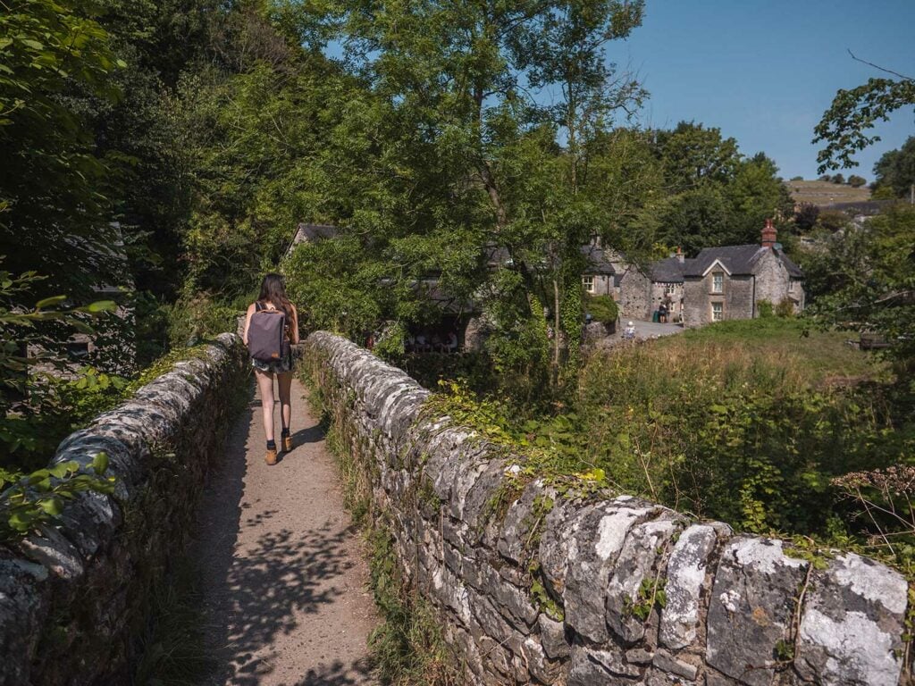
Stage 12: Milldale Village
Largely considered the prettiest village in the Peak District, Milldale provides a relaxing and idyllic resting point before the return loop of the walk.
Milldale, now owned by the National Trust, is named after the cornmill which used to sit on the River Dove.
Whilst here you can visit the National Trust information point in the small barn near the bridge, use the toilets across from the bridge and top up your water supplies.
A few steps into the village you can indulge yourself with hot drinks, sandwiches, scones, pasties and icecreams at Polly’s Cottage. This delightful little independent takeaway is open 7 days a week (Apr to Oct) from 10.30am – 4.30. Although there is no seating at the cafe, there are plenty of great spots by the River where you can sit and watch the ducks.
In the centre you will notice a wooden signpost for a pub 1 miles away. This refers to the Watts Russell Arms in Hopedale, a traditional pub with local produce and home-cooked food. I’ve not tried it myself as yet but it currently scores 3.5 on Tripadvisor.

Stage 13: Hall Dale
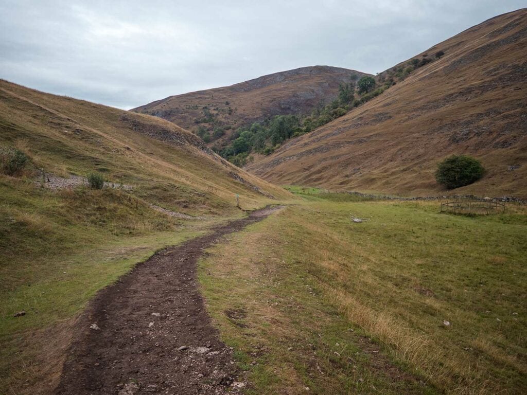
From Milldale you can either go up the very steep overgrown path at the side of the toilets or – as I opted to do – walk up the main road at a right angle to the River Dove for a 5 metres or so and then turn left along the signposted foot path.
This path is very peaceful and a little trickier at points due to being slightly overgrown. It takes you up through forests to the top of the hills.
You then walk over the vast hills before the path slopes gently down towards the river. From here you walk over an uneven and narrow trail which runs parallel to the river, back towards the stepping stones on the Staffordshire side of the River Dove.
Stage 14: Ilam Rock Bridge
Roughly 1 mile along this path you’ll see the Ilam Rock Bridge that you passed on the outbound leg of the walk. Cross over the bridge.
Stage 15: Retracing your steps to the car park
From here you can retrace your steps back to the Dovedale car park. If the stepping stones are busy you can continue past them and take the bridge over the river instead just before you reach the car park.
Dovedale to Thorpe Circular Walk including Thorpe Cloud and Bunster Hill
This walk gives you a mix of the busier parts of Dovedale whilst also taking you away from the main trail to give you some great views and a different perspective of the valley.
Route Details
Walk Type: Circular
Walk Distance: 7 miles
Walk Time: 3-4 hours
Walk Difficulty: Hard
Total Ascent: 611 m/2,004 ft
Highest Point: 312 m/1,023 ft
Walk Description: A circular walk which will take you up to the summit of Thorpe Cloud before descending into the Dove Valley and walking alongside the River Dove, marvelling at the valley’s limestone structures and caves before crossing the river and ascending the steep hillside until you summit Bunster Hill. From here you will descend and wander through fields before arriving back at the base of Thorpe Cloud.
Walk highlights: Thorpe Cloud, Dovedale Stepping Stones, Lovers Leap, The Twelve Apostles, Tissington Spires, Reynards Cave, The Straits, Lion’s Head Rock, Ilam Rock, Bunster Hill
Walk Terrain: A combination of a wide tarmac track, wide gravel tracks, stone steps, steep ascents on loose earth (such as to reach Reynard’s Cave), unpaved and uneven trails through undergrowth and over hills.
Download Maps: GPX Track
Disclaimer: These GPS files are provided free-of-charge for personal use only and may not be uploaded elsewhere. By downloading you acknowledge that walking can be dangerous and this GPS data is provided without any warranty and you absolve this website for any liability.
Stage 1: Thorpe Cloud
You start at Thorpe car park (which is free!) and walk down the road. Just before you reach Peveril of the Peak hotel – which is situated at a bend in the road – take the footpath which is on your right.
The trail will take you through a field until you reach a small gate. Go through the gate. You will notice a hill in front of you. Walk to the left of the hill, and note if the red flag is flying on the hill. If the flag is flying, then you need to keep back as it means the rifle range is active.
You will soon notice Thorpe Cloud on the horizon.
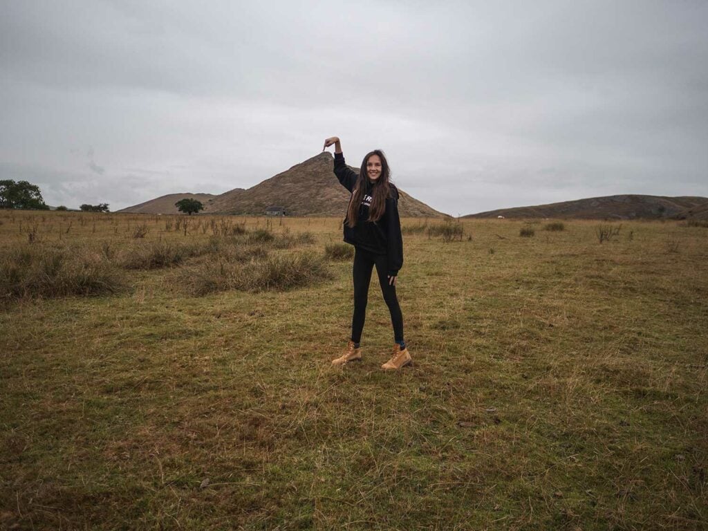
Wander across the field towards Thorpe Cloud. You will then go through a small gate which will take you to the base of the hike up Thorpe Cloud.
Due to safety and environmental damage only one route up Thorpe Cloud is open at the moment. The blue markers will highlight the route and conveniently the route is the one right in front of you. You will need to use this route to both ascend and descend Thorpe Cloud.
It’s a steep yet short climb to the summit of Thorpe Cloud. Ensure you are wearing sturdy footwear as much of the trail consists of loose gravel. Also be aware that the trail can get slippery if it has been raining.
The views at the top of Thorpe Cloud are stunning. Immediately you will be greeted with views of rolling hills. However, the best views can be seen when you make your way towards the front of Thorpe Cloud and find yourself overlooking the Dove Valley. You can even see the stepping stones! Just make sure you watch your step as the terrain is very uneven. And don’t go too close to the edge!
Stage 2: Lin Dale to the Stepping Stones
Descend from Thorpe Cloud down the same route on which you came. From there walk to the right towards Lin Dale valley, following the path down.
Once in the valley follow the path until you reach the River Dove with the iconic Dovedale Stepping Stones on your right.
Stage 3: Walk Alongside the River Dove to Ilam Bridge
Follow the River Dove along the dale following sages 3 through to 7 from the above circular route to Milldale. However, instead of passing Illam Bridge like in the former walk, we are going to cross it.
For this stage of the walk enjoy the iconic sights: Loves Leap, the Twelve Apostles, Reynard’s Cave, The Straights, Lion’s Head Rock, Pickering Tor and Ilam Rock Bridge.
Stage 4: Ilam Bridge to Dovedale Woods
Cross over Ilam bridge. You will notice a small cave near the base of Ilam rock.
Follow the trail which can get narrow and overgrown in places until you see a fork in the path accompanied by a National Trust sign with directions. Follow the path to the left which is signposted for Illam.
The steep trail will take you through the Dovedale Woods, gradually ascending one of the great hills which borders the valley. The climb is steep and the trail is narrow and uneven so sturdy footwear is essential.
At the top of the hill you will find the path meandering through the Dovedale Woods and will occasionally catch a peak of the Dove Valley and its majestic limestone structures. Here you get a bird’s eye view of the valley, all the way to the farmland which sits atop the cliffs on the other side, which you simply aren’t aware of when walking through the valley itself.
Stage 5: Air Cottage to Bunster Hill
The trail will eventually leave the Dovedale Woods, taking you through a vast field with lovely views of Dove Valley. The trail will track below Air Cottage, a cottage sitting in prime location at the very top of the hill, with panoramic views over Dovedale.
This next part can be a bit confusing. As soon as you have passed the cottage, take the path which takes you up, just to the left of it. Don’t continue straight towards the woods, like I did, as you will soon be greeted with a sign that states ‘Private Lane’ and have to head back to the correct trail.
Go through a wooden gate and turn left, following a track which will head through a stone wall. Just before the wall, the path will fork. Follow the path which goes to the left of the wall, passing a derelict farm building on the left. You should soon see signage for Bunster Hill.
Stage 6: Bunster Hill
You will soon find yourself faced with a gate, the sign for Bunster Hill just behind it. Walk through the gate and head up towards the summit of the hill. Don’t do what I did and start your descent here, following the path to the right, as you will find yourself having to ascend yet another hill to rejoin the recorrect path and unnecessarily tire yourself out!
Follow the trail (which can get pretty hard to see!) along the spine of Bunster Hill. You will eventually come across a slight dip in the hill and from here you will find stunning views of Thorpe Cloud.
Descend through this gap, heading towards Thorpe Cloud. The path will snake round to the left and eventually take you to a wall which you have to climb over.
Stage 7: The Final Stretch
The last stretch of the walk will take you through fields, the Izaak Walton Country House Hotel appearing on your right. You may decide to stop off here for a quick drink or snack before continuing.
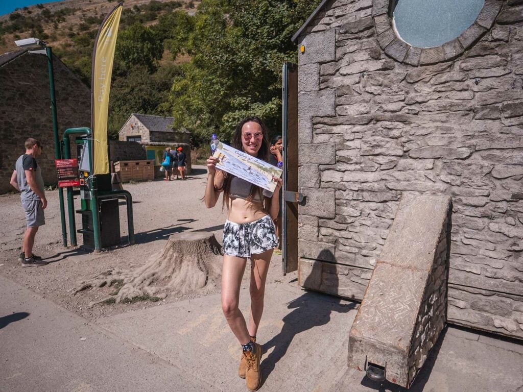
On the other side of the field is a gate which will take you into a cluster of trees. You will emerge beside Dovedale carpark, another opportunity to purchase some drinks and snacks or use the bathroom. You may also wish to purchase a certificate from the kiosk which shows you have conquered Thorpe Cloud!
Follow the path from the carpark which points to Dovedale. On the other side of the Weir is a bidge which crosses over the River Dove. Cross this bridge and you will find yourself in the foothills of Thorpe Cloud.
Wander through the field, the mighty Thorpe Cloud on your left. It’s a gentle, sloping ascent to the dry stone wall which sits behind the hill. You should recognise the gate from where you started your journey several hours ago, which is beside the trail to Thorpe Cloud.
Go through the gate and retrace your steps through the field, the rifle range on your left, until you eventually go through another gate and find yourself on the road.
On your way back to the carpark you may wish to stop at The Old Dog pub for some drinks and food.
Dovedale to Ilam Park Circular Walk
You might be interested in the walk from Ilam Park to Dovedale for a number of reasons. Ilam park is another parking option for busy times and also for large vehicles who would struggle to fit down the narrow road to Dovedale car park. You might also be staying at the Ilam Park Youth Hostel or simply want to visit both sights.
The circular walk takes a couple of hours and spans 4.4 miles along footpaths over farmland. You can view the walk details on the national trust website.
Route Details
Walk Type: Circular
Walk Distance: 4.4 miles
Walk Time: 2-3 hours
Walk Difficulty: Moderate
Total Ascent: 611 m/2,004 ft
Highest Point: 312 m/1,023 ft
Walk Highlights: Dovedale Stepping Stones, Lovers Leap, The Twelve Apostles, Tissington Spires, Reynards Cave, The Straits, Lion’s Head Rock Ilam Rock, Thor’s Cave
Walk Terrain: A combination of a wide tarmac track, wide gravel tracks, stone steps, steep ascents on loose earth (such as to reach Reynard’s Cave), unpaved and uneven trails through undergrowth and over hills.
Dovedale to Thor’s Cave Walk
If you fancy a really adventurous walk you can walk from Dovedale stepping stones to incredible Thor’s Cave.
Route Details
Walk Type: Circular
Walk Distance: 11 miles
Walk Time: 5-6 hours
Walk Difficulty: Hard
Total Ascent: 1414 ft
Highest Point: 312 m/1,023 ft
Walk Highlights: Dovedale Stepping Stones, Lovers Leap, The Twelve Apostles, Tissington Spires, Reynards Cave, The Straits, Lion’s Head Rock Ilam Rock, Thor’s Cave
Walk Terrain: A combination of a wide tarmac track, wide gravel tracks, stone steps, steep ascents on loose earth (such as to reach Reynard’s Cave), unpaved and uneven trails through undergrowth and over hills.
This walk starts in the Dovedale car park and takes you along the usual route to the stepping stones then along the Dove Valley to Ilam Rock bridge. From there you walk over to Wetton and then a short walk down Thor’s lane to Thor’s Cave. Then walk back towards Illam and finally back to the Dovedale car park.
Tips for Visiting Dovedale Stepping Stones
- There is no phone signal in Dovedale so if you’re planning on going on a longer walk beyond the stepping stones, then I’d recommend downloading an offline map or taking a printed map.
- Take Coins for the car park (see rates) and toilets. If you’re a national trust member, take your card and show it to the volunteers for a parking ticket or else I’ve been advised you can simply leave it in the windscreen.
- To avoid huge crowds and a full car park arrive before 9am or after 6pm. If possible avoid weekends altogether.
- Bring snacks and drinks as the food Kiosk in the car park can have long queues and only opens at 9. The only other food options being Polly’s Cottage in Milldale (3 miles away) and Ilam Park tea rooms (1 mile away).
- In sunny weather, taking a picnic as sitting by the sides of the River Dove can be idyllic with children and even adults having a paddle in the water.
- If there has been heavy rainfall check water levels on the River Dove at Izaak Walton here as the stepping stones can become submerged.
Dovedale Stepping Stones Packing List
- Rucksack
- Reusable water bottle – I found we needed 2 x 70ml water bottles per person for the walk to Milldale during hot weather. You can top up water bottles at Milldale with a drinking water tap by the toilets.
- Loose change (coins) for the parking machine (see rates) and 20p for the toilets.
- Snacks / Picnic
- Swimwear and microfibre towel if you’re considering a paddle or a swim.
- Torch for exploring the caves
- Camera – the Dovedale valley is one of the most beautiful in the Peak District with loads of points of interest to photograph.
- Walking boots with ankle support if you’re planning to walk beyond the stepping stones as the path gets more uneven.
Dovedale Stepping Stones FAQ’s
Below are some popular questions about Dovedale.
How Long of a Walk is Dovedale Stepping Stones?
The walk from Dovedale Carpark to the Stepping Stones is 0.4 miles and takes around 10 minutes.
How Long does it take to Walk from Dovedale to Milldale?
The full circular walk from the car park, past the Stepping Stones, down the Dove River to Milldale and back to the carpark is 6 miles and takes around 2.5 – 3 hours.
Is Dovedale Stepping Stones Dog-Friendly?
Yes, it’s a perfect walk for dogs! Even the smallest of dogs seem to make it over the stepping stones, sometimes falling in from time to time but they seem unscathed. Please note dogs must be kept on a lead for the safety of the wildlife and sheep.
Is Dovedale an Easy Walk?
Walking to the Dovedale stepping stones is an easy 5 – 10 minute stroll along a well maintained and level path. Going over the stepping stones is fairly easy as they are level and close together.
Walking to Milldale is slightly more strenuous due to the distance you cover (6 miles round trip) and it also includes some climbs such as the climb to Lover’s Leap.
Is Dovedale a Hard Walk?
The 10 minute walk to the stepping stones at Dovedale is not a hard walk. If you want to do the full circular walk to Milldale it’s a slightly harder walk covering 6 miles and taking around 3 hours.
Looking for a really hard and more adventurous walk? The circular walk from Dovedale to Thor’s cave is a real expedition, covering 11 miles and taking 5 – 6 hours.
Are There Toilets at Dovedale Stepping Stones?
There are toilet facilities at the Dovedale car park operated by Peak District National Park. They require a 20p coin to enter. Due to the popularity of the location, they are not in the best state when I’ve used them but they’re better than nothing.
There are also toilets at Milldale (3 miles away) if you choose to do the circular walk to Milldale.
What has been filmed at Dovedale?
Due to Dovedale’s natural beauty, it has become a prime filming location. The banks of the River Dove featured in BBC’s 2006 version of ‘Jane Eyre’. The scenic valley also made an appearance in ‘The Other Boleyn Girl’ (2008), Robin Hood (2010) and ‘Let Sleeping Corpses Lie’ (1974).
Food and Drinks Near Dovedale Stepping Stones
If you are visiting the Dovedale Stepping Stones then I’d highly recommend taking your own snacks and drinks, especially if visiting out of season (opening times vary for the refreshment stands) and especially if you are embarking on one of the longer hikes through the valley.
If you are visiting in season (spring and summer) then there’s a range of delicious eateries near the Dovedale Stepping Stones.
We’ve found a great National Trust food kiosk at the carpark and a fantastic independent Polly’s Cottage cafe-takeaway in Milldale for mid-walk refreshments. More on these under “cafes” heading below.
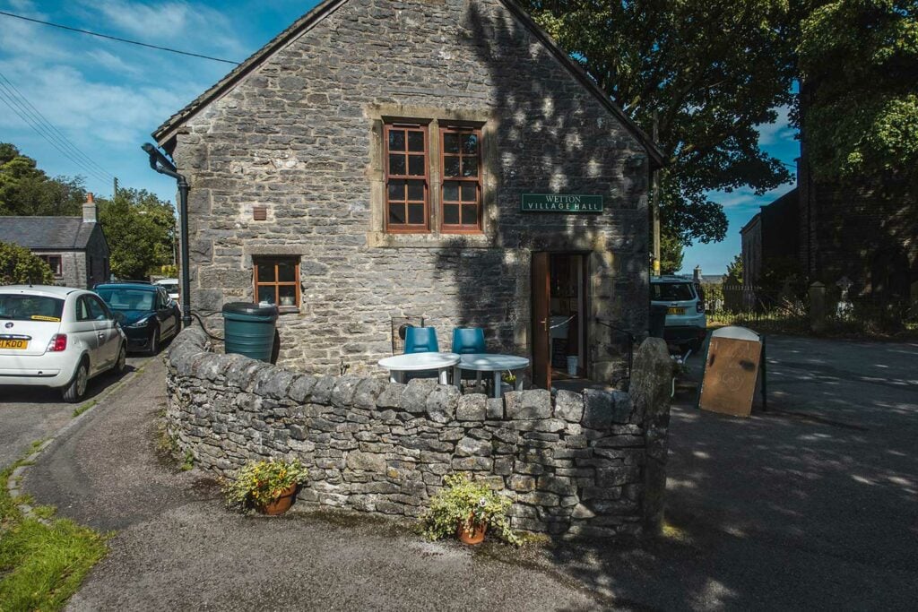
If you decide to drive or walk over to Thor’s cave I’d definitely recommend popping into Wetton Village Hall and Tea Rooms for a real treat (usually only open Friday, Saturday and Sunday).

Cafés Near Dovedale Stepping Stones
In terms of cafés near the stones, there aren’t many options. In the spring and summer months you can find a kiosk in the main Dovedale carpark. Otherwise the nearest cafés are either is in the village of Milldale, a 3 mile walk from the stones, or at Ilam Park, a 2 mile walk from the stones.
National Trust Kiosk
This kiosk is conveniently located within the Dovedale carpark. It sells a range of snacks from ice cream to sandwiches, teas and coffees to cold drinks.
I’ve not been able to verify opening times but I would imagine it would match the car park opening times of 9am to 7:30pm. May be closed at quiet times of the year.
There’s no seating at the kiosk itself but as you walk from the kiosk towards the Dove Valley you will find walls and tree stumps which you can perch on to enjoy your snacks.
Google reviews: none | My Score: 5/5
Polly’s Cottage in Milldale (3 miles away)
This is a lovely well-rated independent café selling hot pasties, ice cream, freshly-made sandwiches and hot drinks. There’s no seating at the café itself but the River Dove is just a few metres away where there are some benches on which you can sit and enjoy your snacks whilst watching the ducks swim in the river.
Open 7 days a week (Apr to Oct) from 10.30am – 4.30. It’s only open on weekends between November and March (weather permitting) and is closed for January.
Check their Facebook page for latest opening hours.
Google Reviews 5/5 | My Score: 5/5
Ilam Park Manifold Tea-room (2 miles away)
This sprawling estate in Ilam houses a tearoom which is operated by the National Trust. It sells a wide range of eats from lunches to hot and cold drinks, cakes and afternoon tea.
Open 7 days a week 10am – 50pm between mid-February and late-October. Opening times reduce to 10am – 4pm in the winter. Check opening times here.
Google Reviews 4/5
Wetton Village Hall and Tea Rooms (5.5 miles away)
This gem of a café is located in the small village of Wetton, near Thor’s Cave. The café serves lunch and homemade cakes as well as hot drinks. Tea is served in traditional bone china tea sets and there’s a shop within the hall where you can purchase locally-made items.
Usually open Friday, Saturday and Sunday. Check Facebook page for current opening times as these vary.
Google reviews: 4.8/5 | My Score: 5/5
Wetton Mill Tea Rooms (7 miles away)
Just outside the town of Wetton, this cosy tea room is in the heart of the Manifold Valley, perched right upon the river. It’s in a Grade 2 listed building owned by the National Trust. The café serves a selection of hot drinks including loose leafed tea, homemade cakes, sandwiches and ice creams.
Open Thursday to Sunday 10am – 5pm. Check the Facebook page for opening times.
Google Reviews: 4.6/5
Pubs Near Dovedale Stepping Stones
There are several pubs near the Dovedale Stepping Stones including the Izaak Walton Country House and the Old Dog which are both only a 10-15 minute walk from Dovedale carpark.
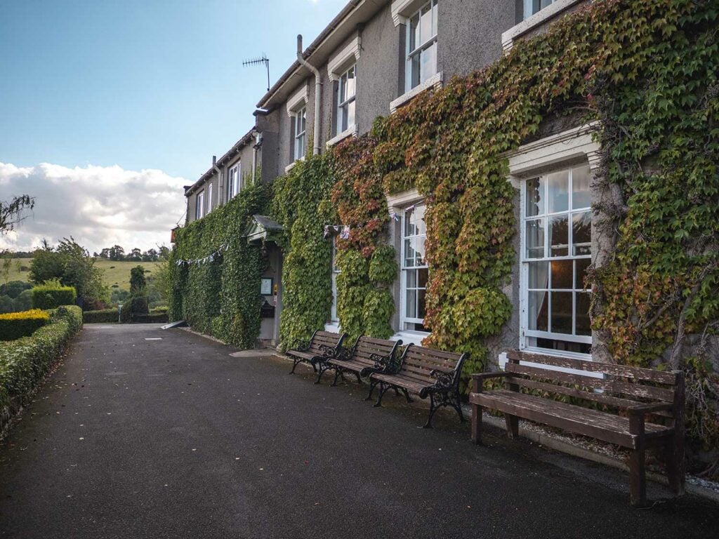
The Izaak Walton Country House Hotel (0.6 miles away)
This hotel is conveniently located just a 5 minute walk from Dovedale carpark. At the hotel you can enjoy lunch, hot drinks or even an alcoholic beverage or two. The hotel offers a range of outdoor and indoor seating.
I enjoyed some tea here and a pint of local ale after a long hike around Dovedale and found the service to be great (as well as the drinks!).
Google Reviews (for hotel): 4.3 / 5 | My score (for drinks only): 5/5
Watts Russell Arms (4 miles away)
Just 1 mile away from the village of Milldale, this traditional pub uses local produce in its home-cooked food.
Open 12pm – 9pm Closed Wednesdays. Check opening times on their website.
Google reviews: 3.9/5
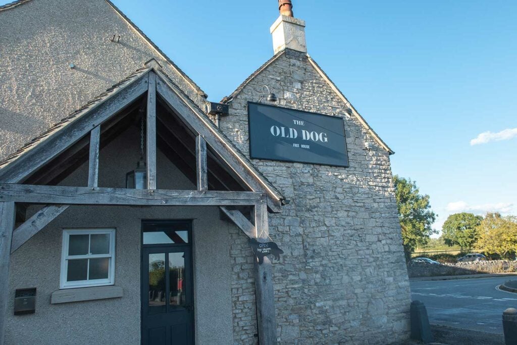
The Old Dog (2 miles away)
Local, unfussy, quality food and drinks near Thorpe Cloud. The pub offers both outdoor and indoor seating.
I had a pizza here, it was reasonably priced and tasty. The inside is cosy but the light was a little dark for my liking so I sat at the outside tables in the sun.
Open Wednesdays to Sundays, 3pm – 10pm. Check opening times on their website.
Google reviews: 4.5/5 | My score 4.8/5
Coach and Horses (3.5 miles away)
Family owned pub with home-cooked food and cask ales. The pub doesn’t allow dogs.
Open 7 days a week, 12pm – 10pm. Check opening times on their website.
Google reviews: 4.5/5
Restaurants Near Dovedale Stepping Stones
The George at Alstonefield (4 miles away)
Fine dining in a relaxed atmosphere.
Opening times vary. I’d recommend checking their website here.
Google reviews: 4.3/5
Places to Stay Near Dovedale Stepping Stones
With so much to do in the Peak District National park it can make good sense to stay locally for a week in order to explore the wonders of the Peaks.
Campsites
Below are the most local campsites to The Stepping Stones
Common End Farm Campsite – Swinscoe
Google reviews: 4.6 / 5
Thorpe Cloud View Camping – Rowfields
Google reviews: 5/5
Hostels & Hotels
YHA Ilam Hall Hostel
Cost-effective accommodation within a 17th century gothic manor. Just 25-minutes walk to Dovedale Stepping Stones.
Google reviews: 4.6/5
The Izaak Walton Country House Hotel
Named after the author of the famous fishing book “The Complete Angler”, this 17th-century hotel features access for trout finishing. It’s just 11 minutes to walk to the Dovedale car park or a 3 minute drive.
Google reviews: 4.3 / 5
Final Thoughts
The Dovedale Stepping Stones are set in a magical location, overlooked by craggy limestone peaks and dense forests. They are conveniently only a 10 minute walk from the nearest carpark and the level tarmac path to the stones makes them accessible for all.
In my opinion the stepping stones are well worth a visit; the beauty of the valley is best seen with your own eyes.
I would, however, be sure to plan your trip to Dovedale beforehand to ensure you arrive at the valley at the right time of day.
If you want to miss the crowds then arriving very early in the morning or late in the evening is a must. My experiences visiting Dovedale in the middle of the day compared to the quiet mornings were very, very different.
Have you been to Dovedale before? Share your experience in the comments!
Ellamckendrick.com is a free online resource. If you have found this website useful for planning your adventures, you can show your support by buying me a coffee. Thanks so much!

This is a great article! Wish I’d have read it before my first visit as the information about best times to visit would have been really helpful. I’m going again with my extended family in a few weeks and we’re going to do the circular walk to Milldale. Do you know if the Milldale cafe will be open?
Hi Katharine, glad you found the article useful. Polly’s cafe in Milldale is now closed for the season and re-opens in April. It is open 7 days a week (Apr to Oct) from 10.30am – 4.30. If you don’t mind walking an extra mile from Milldale there is the Watts Russell Arms in Hopedale which is open all year.